Northwestern U.S. residents can anticipate stormy conditions this week, causing gusty winds and rounds of rain. People can anticipate localized flash flooding and travel delays.
According to a weather report by the National Weather Service (NWS), next week will see a combination of rainy and hotter temperatures. In the Pacific Northwest, residents can expect rounds of heavy rains and snow melt on Monday.
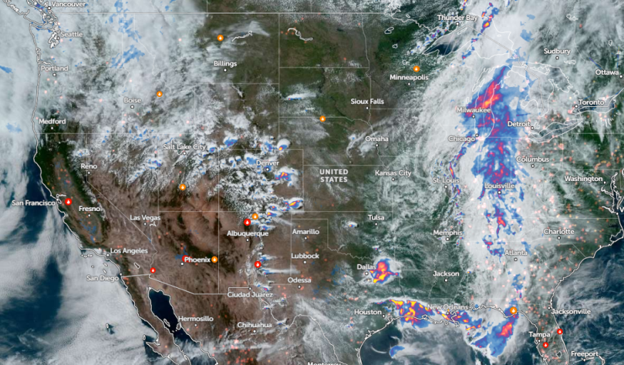
Weather in the Pacific Northwest: Where will stormy conditions unload?
The forecast also signals the official start of the 2024 Atlantic hurricane season. Homeowners should be aware of challenging situations, particularly in the Southern US. Additionally, people should keep alert for very wet conditions in the following areas:
- Seattle
- Portland
- Springfield
- Medford
- Boise
- Kennewick
- Spokane
- Missoula
People with travel plans should be alert for windy and localized flooding concerns. Limiting outdoor activities is essential in the Pacific Northwest due to flooded areas, which can result in slower commutes or hazardous travel.
In an NWS Weather Prediction Center report, the forecast monitors the development of a warming trend in the western U.S. next week. People are warned of possible dangerously hot conditions building in the Interior West and Southwestern U.S.
Additionally, NWS San Diego reports a slight cooling temperature this week. However, the beginning of the week could unleash a warming, particularly in the desert areas.
In the Bay Area, the forecast monitors the development of high pressure over the Pacific. Residents can anticipate higher temperatures with highs in the 90s to nearly 100 degrees in North and East Bay. On Wednesday, residents should expect highs in the 90s to lower 100s.
From June 4 to 7, the forecast noted the potential heat conditions or significant warming trend in the following areas:
- Bend
- Boise
- Redding
- Reno
- Fresno
- Las Vegas
- San Diego
- Phoenix
- Albuquerque
- Phoenix
- Provo
- Denver
- Casper
- San Diego
In Los Angeles, residents should keep alert for hotter temperatures on Tuesday through Thursday. There is a chance of highs in the 90s to low 100s.
Prolonged exposure to hotter temperatures can potentially threaten vulnerable populations, particularly pregnant women, newborns, children, the elderly, and people with chronic illnesses.
In addition to weather in the Pacific Northwest, strong winds are expected to increase from Monday to Thursday. The forecast warns that gusts could reach 30 to 50 mph, especially in the higher mountains. Residents should watch out for localized power outages and tree damage.
The areas with strong winds are expected in the following areas:
- Spokane
- Bend
- Boise
- Casper
- Great Falls
- Calgary
- Bismarck
- Fargo
- Minneapolis
- Sioux Falls
- Winnipeg
- Regina
Weather Preparedness in the Pacific Northwest
Due to potential weather concerns in the Pacific Northwest, people are advised to watch out for changing weather conditions, including storms and hotter temperatures.
Checking the road conditions is essential in the Pacific Northwest, particularly if they have any travel plans. Additionally, having emergency supplies is advisable as the 2024 hurricane season begins.
Read also: Northwest, Midwest Weather Forecast: Strong Storm to Unload Wet Weather Pattern This Early June
For more similar stories, don't forget to follow Nature World News.
© 2025 NatureWorldNews.com All rights reserved. Do not reproduce without permission.


