Residents in Minnesota and Iowa can expect potential rounds of heavy rains, which could trigger possible flash floods and flooding concerns. Commuters can experience slower commutes and hazardous travel, which could extend until Independence Day.
The National Weather Service is also monitoring the impacts of severe thunderstorms in northern Missouri and Iowa this early week. Travelers can face the following concerns:
- damaging winds
- large hail
- excessive rainfall
Recently, the NWS reported a severe thunderstorm potential in the following areas:
- Northern Plains
- Central Plains
- Nebraska
- Dakota
In the eastern and southern U.S., there is a chance of unusual heat spreading over Independence Day.
Weather in Iowa and Minnesota: Where Will Severe Thunderstorms Unload?
NWS noted that severe thunderstorms can hit the Midwest this midweek. Considering the weather dangers, homeowners should keep updated with the latest advisories and weather information this week.
There is also a chance of unsettled weather in the Southeast and southern Rockies. Residents should be alert for a chance of localized flash flooding. From Kansas to Iowa, the advisory warns of the following weather risks:
- Damaging winds
- Tornadoes
- Large hail
Communities in low-lying areas are considered vulnerable to potential flooding concerns. Homeowners should watch for Flood Watch and weather advisories, particularly in parts of Iowa with possible flash floods.
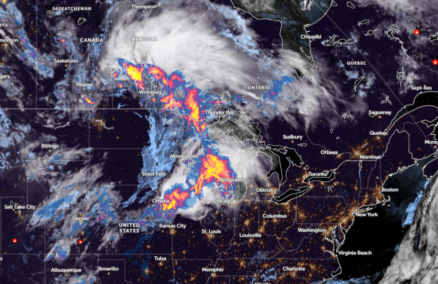
The advisory shows potential rain and thunderstorms in northern Minnesota and a likelihood of flooding and thunderstorms in northeast Minnesota.
In addition, the NWS monitors the development of active and stormy weather affecting portions of the northern Rockies and Midwest. A thunderstorm condition can affect portions of northeast Kansas to central Wisconsin.
On Wednesday, additional potent thunderstorms can impact the central and southern Plains, including in the mid-Mississippi Valley.
For the upcoming Fourth of July, possible showers and thunderstorms can unload in parts of the northern Plains, Midwest, Mid-Atlantic, and Ohio Valley. Additionally, residents in eastern Kansas, central Missouri, and southern Missouri can face the highest possibility of severe weather.
Hotter Weather Outlook in South-Central US
In other parts of the U.S., the forecast shows over 60 million residents could anticipate heat-related watches and warnings this early July. Over 60 million people are considered at risk of heat concerns in the south-central and western U.S.
In the southern Plains, high temperatures are likely midweek, reaching the upper 90s and low 100s. The combination of low relative humidity and hotter temperatures can likely spark potential wildfires.
In the event of high temperatures, vulnerable populations are mostly at risk of unusual heat. It is important to keep updated with heat warnings or advisories this week, particularly for people with travel plans on July 4.
If there are outdoor plans, people should stay hydrated at all times. Additionally, parents should let their children inside a hot vehicle alone due to potential dangers.
For more similar stories, don't forget to follow Nature World News
© 2025 NatureWorldNews.com All rights reserved. Do not reproduce without permission.


