Severe thunderstorms are threatening the states of Nebraska and South Dakota as of Monday, July 1, potentially bringing damaging winds and sporadic hail, according to the National Weather Service (NWS).
Severe weather hazards such as isolated tornadoes and flash flooding due to heavy rain are also possible over the affected region, which may experience localized travel disruption starting Monday.
Meanwhile, the NWS also issued heat wave alerts for at least 50 million Americans across the southwestern United States. The weather authority described the looming extreme weather event as a "dangerous heat" that can potentially impact the south-central parts of the country and portions of the West Coast.
Hot temperatures and elevated humidity levels may also increase wildfire risks, the US weather forecast says.
The intense heat indexes recorded across the country over the past month confirm previous summer forecasts by US meteorologists. In May 2024, AccuWeather experts forecasted an above-average summer season this year, with exceeding temperatures by at least 2 degrees from historical averages.
The National Oceanic and Atmospheric Administration (NOAA) also made similar forecasts earlier this year.
Severe Thunderstorm Forecast
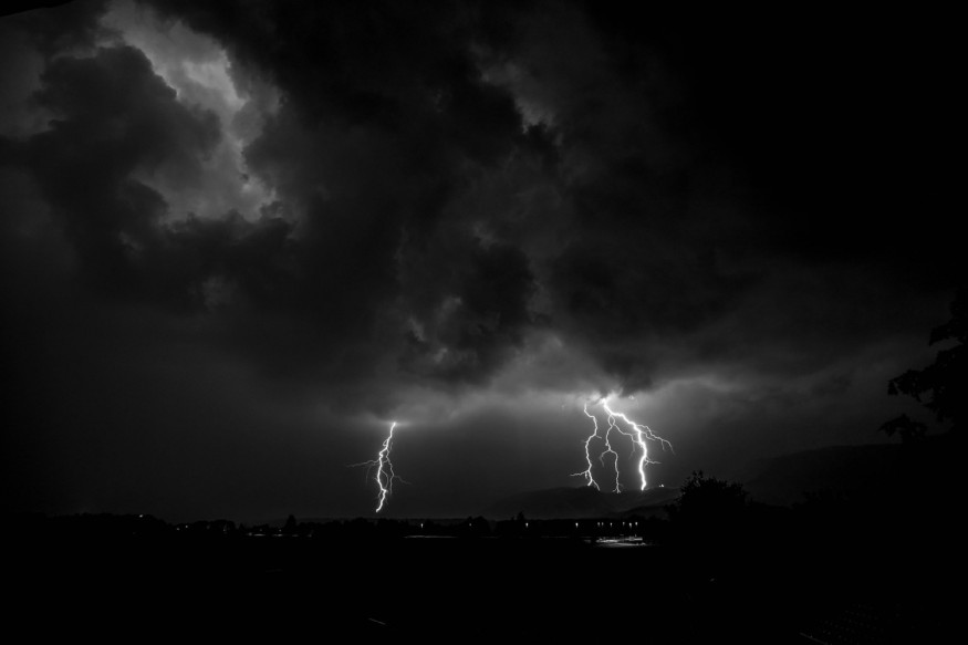
In its recent short-range forecast, the NWS' Weather Prediction Center (WPC) at 4:09 a.m. EDT (local time) on Monday warned of the lingering severe thunderstorms and heavy rain over the northern Great Plains and Midwest regions. The WPC's severe thunderstorm forecast centers around Nebraska and South Dakota, as well as their surrounding states which could experience the mentioned severe weather hazards.
The thunderstorm forecast highlights the potential for significant flooding caused by torrential rain and swollen rivers, especially for the upper Mississippi Valley. The stormy weather is caused by approaching frontal boundaries which can bring multiple severe storms and increased heavy rainfall events across the northern Plains and upper Midwest starting Monday.
Heat Wave Alerts
In addition to the severe thunderstorm forecast, the NWS warned about an ongoing heat wave spanning southern Oregon to southeast California. This extreme weather event has resulted in the issuance of heat wave alerts, including excessive heat warnings, watches, and advisories. They will take effect as early as Tuesday, July 2. Furthermore, scorching temperatures may continue until the end of the week, the US weather agency says.
Back in May, AccuWeather's Paul Pastelok predicted that the US summer season 2024 would involve heat waves for multiple areas across the Great Plains to the Northeast US regions. This means extreme temperatures may hit many states, ranging from Texas to Maine until August 2024.
Before the current season, meteorologists hinted certain conditions for an above-average US summer. In February 2024, the NOAA's Climate Prediction Center (CPC) reported that drought conditions were detected in large portions of the Southwest, Plains, and Pacific Northwest. Meanwhile, the agency forecasted a rainy summer season or increased precipitation for the Northeast.
© 2025 NatureWorldNews.com All rights reserved. Do not reproduce without permission.


