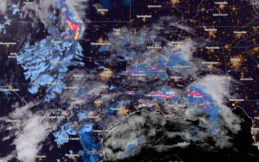
Central U.S. can anticipate rounds of rain and thunderstorms next week, with a risk of thunderstorms and damaging winds, according to a weather report.
Parts of the Central U.S. have recently experienced severe weather and isolated tornadoes. The beginning of May unleashed challenging weather conditions, causing damage to properties and major travel disruptions.
Next week, homeowners can likely anticipate rounds of rain. People near streams, particularly in low-lying areas, are vulnerable to small to severe flooding.
Weather in the Central U.S: Where Will Rounds of Rain Unload?

Recently, the south-central U.S. suffered from threats of flooding rainfall and flash flood risks. According to an NWS Weather Prediction Center, potential heavy rain and flash floods could threaten portions of the South. Commuters can experience widespread totals of three to six inches.
While there is a brief break from severe weather, there is still a chance for a poor weather outlook next week. In the late week, homeowners should expect wet weather conditions in the following areas:
- Colorado Springs
- Dodge City
- Amarillo
- Oklahoma City
- Little Rock
- Springfield
- Kansas City
- Omaha
- Cedar Rapids
- Sioux Falls
In addition to thunderstorms, there is still a chance of thunderstorms and gusty winds. In Little Rock, the latest advisory shows that showers could unload in southern Arkansas. On Monday, potential thunderstorms can occur.
In Omaha, the rounds of rain could unload this weekend and early next week. Meanwhile, NWS Austin and San Antonio reported that isolated to scattered thunderstorms are likely, with risks of large hail and damaging winds.
Additionally, Dodge City residents should anticipate light showers and lightning. However, the rain is not expected to be severe.
Read also: Northeast Mother's Day Weather: Heavy Rains, Localized Small Hail Likely to Impact This Weekend
Weather in Southeast US Next Week
In the southeast coast and Plain, the latest weather report warns of a potential pair of storms, bringing a challenging weather outlook from Texas to Florida.
On Mother's Day until early next week, renewed flooding concerns and travel risks can unfold in Wichita, Springfield, Oklahoma City, Abilene, Houston, and New Orleans.
According to an NWS Houston report on May 12, a Flood Watch was issued in the Piney Woods region. Additionally, isolated to severe storms are likely.
On Monday, potentially isolated tornadoes and flooding rain could hit Dallas, Victoria, Lake Charles, New Orleans, and Mobile. For Tuesday, it will unload in Jacksonville, Savannah, Albany, and Charleston.
When commutes are not really important, homeowners should check first the latest forecasts to avoid being stranded on major roads.
To keep safe from severe weather, having emergency kits can also save during challenging situations like isolated tornadoes and hail conditions.
Read also: Texas, Southern US Weather Forecast: Renewed Flooding to Trigger Hazardous Commutes This Week
For more similar stories, don't forget to follow Nature World News.
© 2025 NatureWorldNews.com All rights reserved. Do not reproduce without permission.


