Heavy rains might hit southern U.S., particularly in Texas. People can expect challenging weather, including flooding risks.
This week, people in flood-prone areas are the most vulnerable to severe and extreme flooding. Additionally, motorists should check the road conditions before traveling to prevent hazardous travel.
As reported by the National Weather Service (NWS) on May 9, vehicle-related flooding fatalities account for 50%. Motorists are advised to avoid floodwaters or wait until the weather improves.
The NWS Weather Prediction Center warns of dangerous flash flood concerns in the Mid-South. Meanwhile, heavy rains can unload in the Southeast.
The second week of May could be challenging in the U.S., especially in the central portions, with a chance of isolated tornadoes and hail. Limiting outdoor plans is advisable, particularly in flood-prone areas.
Southern US and Northeast Weather Outlook: What Can People Expect This Week?
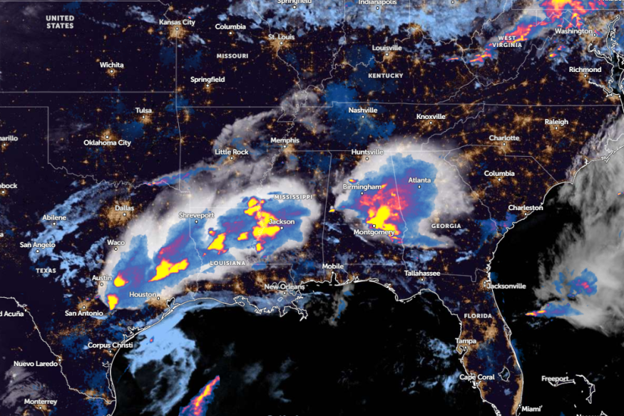
People with travel plans should reconsider this week's weather due to potential heavy rains and renewed flooding. Northeastern Texas residents are at risk of heavy rains and flash floods, particularly in portions of Interstate 10 to Interstate 20.
On the weekend, rounds of rain are forecast in Kansas City, Denver, and Houston. Meanwhile, a less humid outlook could unload in Memphis, Miami, and Jacksonville, with two to four inches of rain possible.
From the weekend to early next week, renewed flooding and local flash flood threats can occur in the following areas:
- Waco
- San Antonio
- Houston
- Shreveport
- Montgomery
- Savannah
- Jacksonville
- Tampa
In Houston, the recent advisory warns of scattered storms this week. Homeowners should stay alert for potential severe forecasts affecting portions of north Interstate 10. There is also a risk of damaging winds and large hail.
Additionally, the rainy outlook could continue until next week. Commuters should keep alert for rounds of showers and thunderstorms in the following areas:
- Lubbock
- Austin
- San Antonio
- Houston
- Corpus Christi
- Odessa
- Lubbock
- Oklahoma City
For Austin and San Antonio residents, large to very hail, damaging winds, and isolated tornadoes are likely. Areas of dense fog in Interstate 35 and the Coastal Plains are also at risk.
Central U.S. Weather Forecast: Where Will Severe Weather Unload?
The latest weather report warns of severe weather risk in the central U.S. People should keep alert for challenging weather outlooks, with threats of hail, isolated tornadoes, and flash floods.
Severe weather conditions can hit Dallas, College Station, Mobile, Atlanta, Charleston, Atlanta, Wilmington, Raleigh, Richmond, and Washington.
When the daily commutes are not essential, commuters should stay at home or stay alert for troublesome weather conditions.
Additionally, storing emergency kits at home is the best option to prepare for a poor weather outlook.
Read also: Gulf Coast Weather Forecast: Widespread Damaging Winds, Lightning Strikes Likely to Threaten Midweek
For more similar stories, don't forget to follow Nature World News.
© 2025 NatureWorldNews.com All rights reserved. Do not reproduce without permission.


