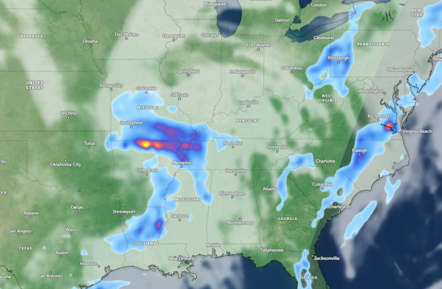
A National Weather Service (NWS) report shows potential heavy rains and thunderstorms can unload in southern Texas and the Mid-Mississippi Valley this week. Travelers can anticipate slower commutes and travel dangers due to the weather outlook.
The NWS weather report warns of severe thunderstorms in the north-central Plains on Monday. On Tuesday, challenging weather conditions can also spread over the Ohio Valley and Great Lakes.
The potential thunderstorms can likely become strong to severe this week, particularly in the mid-Mississippi and southern Texas. Meanwhile, the advisory warns of highly localized flash flood threats in central and northeastern Texas.
Weather Conditions in Southern Texas and Mid-Mississippi Valley
Severe thunderstorms will likely occur on Monday in the northern Plains and upper Midwest. Residents should stay alert for unsettled weather conditions from the Tennessee Valley into the Southeastern US and the Mid-Atlantic States.
Communities in flood-prone areas are the most vulnerable to flooding. Heavy rains can trigger flash floods. Commuters should anticipate flooded and slippery roads this week.
According to an NWS Storm Prediction report, a significant severe weather threat could be unleashed in the Plains. Homeowners should keep alert for dangerous weather, including isolated tornadoes. Challenging weather conditions can also affect portions of southern Nebraska, Oklahoma, and Kansas.
In addition to tornadoes, the forecast warns of damaging thunderstorms, strong wind gusts, and large hail. People are advised to stay alert for tornado warnings and poor weather outlooks.
In Kansas City, the weather advisory monitors the development of a line of strong to severe thunderstorms in the area. A brief tornado, with damaging winds reaching 70 mph, is likely.
For Houston residents, there is a chance of a stormy outlook along the Interstate 10 corridor. Homeowners should stay alerted for a Severe Thunderstorm Watch this week, including in counties such as Jackson, Wharton, and Colorado.
In Little Rock, precipitation is expected this week, with potential showers and isolated thunderstorms. Low temperatures can likely reach the upper 50s to mid-60s. Through Thursday, additional rain is likely.
Severe Weather Preparedness in Parts of U.S This Early Week
The latest weather forecast reveals that a challenging weather outlook could unload in parts of the Mid-Mississippi Valley and Texas this week. Commuters and households can experience slower commutes and hazardous travel, particularly in Texas.
Homeowners can limit any outdoor plans this week to stay safe from severe weather and isolated tornadoes. Checking daily forecasts and weather reports is advisable to stay alert for severe weather.
Additionally, emergency supplies are helpful in challenging situations, including power outages and hazardous weather outlooks.
For more similar stories, don't forget to follow Nature World News.
© 2025 NatureWorldNews.com All rights reserved. Do not reproduce without permission.


