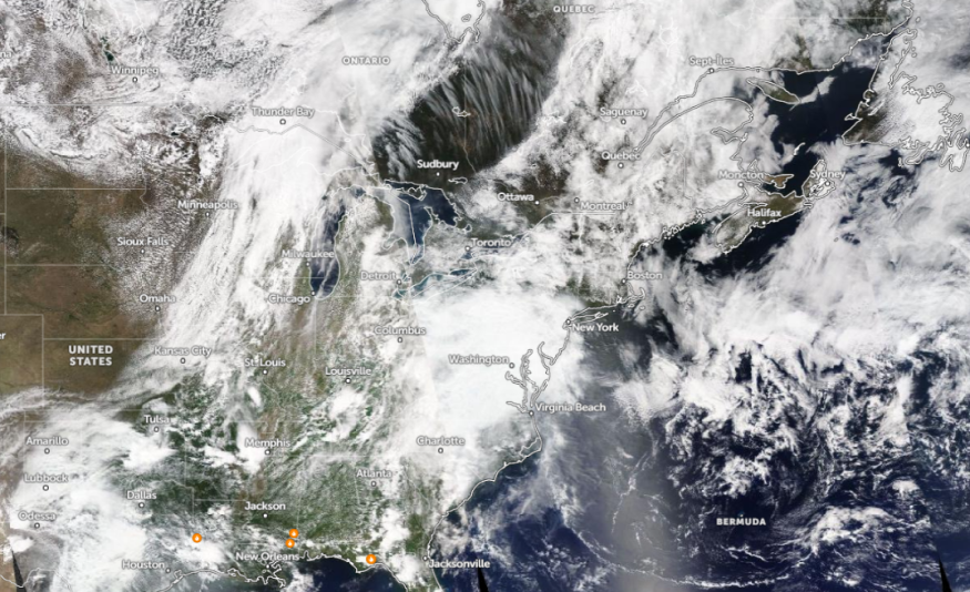
According to a weather report, rain is likely in the Northeast this week. Homeowners can encounter slower commutes and flooding risks, particularly in flood-prone areas.
A National Weather Service (NWS) report shows that potential showers and severe thunderstorms can occur in the Midwest to upper Mississippi Valley. The forecast monitors the development of a system and lower pressure wave, which could potentially have a stormy outlook.
Additionally, potential rain showers can occur in the northeastern part of New England next week. In the mid-South, a chance of thunderstorms is likely.
Weather Outlook in the Northeast This Next Week

In a recent weather forecast, Northeast residents can expect a cooler outlook with possible flooding rainfall. The first week of May is likely rainy in some parts, causing slower commutes due to slippery roads.
This weekend, rain and thunderstorms can occur in Washington, Pittsburgh, Columbus, Charleston, New York, Boston, Portland, Burlington, and Detroit. People in low-lying areas are vulnerable to flooding risks.
In a report by NWS Pittsburgh on May 5, light rain outlook with occasional thunderstorms can impact the region. Homeowners should be alerted to possible lightning strikes.
Next week, the threat of rounds of rain can continue, spreading in the following areas:
- Washington
- Charlotte
- Jacksonville
- Memphis
- Dallas
- Kansas City
- Minneapolis
- Billings
- Portland
- Seattle
For Kansas City residents, the advisory monitors an active weather pattern that could unleash strong to severe storms at the beginning of the week. From Monday to Wednesday, the hazards are damaging winds, large hail, and isolated tornadoes.
In New York, cooler weather outlook and showers can unfold this week. Residents can expect cloudy conditions this week, with potential rain in the western parts of NYC.
Additionally, widespread rain conditions can unfold in Boston next week. Fluctuating temperatures are likely, with a warmer outlook likely on Monday and Tuesday.
In Chicago, the stormy outlook can unload in northern IL, with wind gusts between 40 to 50 mph. Heavy downpours and some hail are likely.
For Houston residents, rounds of showers can trigger flooding risks. People are advised to check for concerns about the Flood Watch. Isolated thunderstorms can also threaten this week.
Read also: hio Valley, Mid-Atlantic Forecast: Wetter Weather Pattern to Cause Slower Commutes This Week
Weather in Other Parts of the US Next Week
According to an NWS report, upper-level lows are affecting the West Coast, causing stormy and active weather in the region. Travelers should watch out for moderate to heavy rain potential.
The high-elevation wet snow can unload in central to northern California. Additionally, residents in the Pacific Northwest, Great Basin, and Rockies can anticipate rain potential.
On the other hand, the warmer outlook can occur in the mid-Atlantic, northern Plains, and central Plains.
Regarding the severe weather outlook, Central Texas and Oklahoma can expect this week.
Read also: Central US Weather Forecast: Severe Storms Likely to Bring Isolated Tornadoes This Weekend
For more similar stories, don't forget to follow Nature World News.
© 2025 NatureWorldNews.com All rights reserved. Do not reproduce without permission.


