The latest weather report reveals that rainy conditions and thunderstorms are likely in parts of Ohio Valley and Eastern Texas this week, causing potential slower commutes and travel concerns.
In other parts of the U.S., severe weather and excessive rainfall can unload in the Great Lakes, Upper Mississippi Valley, and Middle Mississippi Valley. Meanwhile, the ArkLaTex region can anticipate a potential moderate risk of rainfall.
On the other hand, the NWS Climate Prediction Center reports that summer-like temperatures can occur in the Gulf Coast states this second week of May, with areas reaching record highs.
Weather in East Texas and Ohio Valley
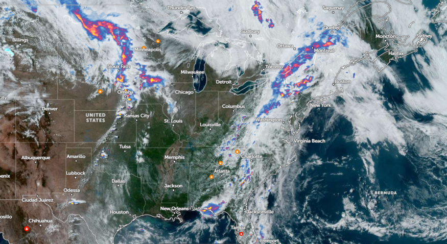
In an NWS report, the forecast monitors the potential storms in the Middle Missouri Valley and an upper-level wave in southern Oklahoma into the eastern half of Texas. Potential slight risks of excessive rainfall are likely, with scattered flash flooding.
Additionally, the National Weather Service (NWS) reports strong to severe thunderstorms are likely in the Central Plains and Missouri Valley on Tuesday. Homeowners should stay alert for risks of damaging winds and large hail.'
A thunderstorm threat is likely in Ohio Valley and East Texas. Commuters should consider the weather forecasts before traveling outside to stay safe from hazardous weather.
Due to the threat of excessive rainfall, people should be aware of the possibility of small to severe flooding, particularly in low-lying or flood-prone areas. Motorists should check for dangerous road conditions due to rounds of rain, causing slippery road conditions.
Meanwhile, weather forecasts for the Upper and Middle Mississippi Valley, including the Great Plains, are available. Commuters should expect showers and thunderstorms on Wednesday.
There is a chance of severe weather in the Central and Southern Plains, from central Iowa to northeastern Kansas. Possible tornadoes and damaging winds could unload, including locally heavy rainfall potential.
In addition, scattered flash floods can occur in northern Oklahoma and southeastern Kansas. NWS Kansas reports stormy conditions can unload in the region, including in Nebraska and northwestern Missouri.
Thunderstorms and Isolated Tornado Preparedness
According to the latest forecasts, thunderstorms and tornadoes are still likely in parts of the U.S. this week. In addition to severe weather, flooding concerns and flash floods are likely.
As a result, homeowners should keep updated with the latest weather reports near their areas, particularly in the south-central U.S. Limiting unnecessary travel is recommended to avoid exposure to poor weather outlook.
Having emergency plans is advisable, especially the threats of isolated tornadoes. Twisters and damaging winds can become more dangerous at night.
It is also best to store emergency kits, which are helpful during evacuations or when stranded inside homes.
Read also: Southern Plains Weather Forecast: Severe Weather to Bring Flash Flood, Tornadoes This Week
For more similar stories, don't forget to follow Nature World News.
© 2026 NatureWorldNews.com All rights reserved. Do not reproduce without permission.


