Locally severe storms and torrential rain are likely this week, causing slower commutes and flooding concerns, according to weather reports. People traveling this late week should keep updated with the latest forecasts to avoid road hazards.
Recently, parts of the U.S. have experienced strong to severe storms in the south-central US, causing isolated tornadoes and hail.
In this week's weather, strong to severe thunderstorms are possible in the Central Plains and Missouri Valley, warning of potentially damaging winds and large hail.
Recently, the Northeast has experienced changing weather conditions, from frost, flooding, and warming trends. Keeping updated with the latest reports is crucial, particularly for low-lying or flood-prone areas.
Locally severe weather in the Northeast
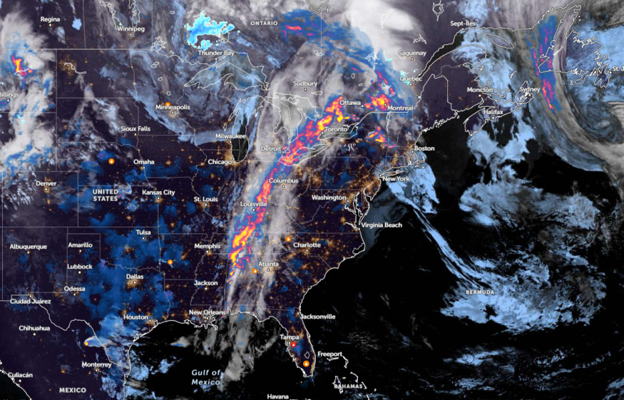
The latest weather forecast monitors the development of a storm system in the central and Northeast, which could bring possible gusty winds and heavy downpours. The stormy outlook can become possible on Tuesday afternoon, unloading small hail, rounds of rain, and locally gusty winds.
The gusty thunderstorms can impact the following areas:
- Pittsburgh
- Harrisburg
- Hagerstown
- Washington
- Roanoke
- Philadelphia
- New York
- Scranton
- Binghamton
- Syracuse
As heavy rains unload in the Northeast, residents can notice a cooler weather outlook in the region. In midweek, the thunderstorm conditions can impact the weekend or late week.
In New York, residents can expect showers and thunderstorms this week. A special weather statement was issued in East Orange, Roselle, NJ, New Rochelle, NY, and Hicksville, NY.
For Boston residents, a roller coaster temperature outlook is likely. On Wednesday, residents can notice an unsettled weather outlook, with a chance of spotty showers.
In Chicago, the forecast shows that two rounds of rain could unload this weekend, particularly on Interstate 55. Homeowners should stay alert for flooding concerns, particularly in open areas.
The midweek outlook is expected to be quiet, with a chance of showers and storms on Saturday.
Meanwhile, a cold front is forecast in Pittsburgh, mixed with thunderstorms and rain. On Thursday, warming weather conditions can occur.
On the other hand, Kansas residents can anticipate a chance for severe storms this week, with threats of damaging winds, hail, and river flooding. On Wednesday, homeowners can expect a wet pattern.
Preparations for Severe Weather Outlook in the Northeast
The latest weather report raised concerns about the severe weather outlook in the Northeast, threatening flooding in the region. Travelers should anticipate the forecasts, and limit outdoor plans to keep safe from thunderstorms and rounds of rain.
If communities live in flood-prone areas in the Northeast, keeping updated with Flood Watch is the best action. When evacuation occurs, it is best to go to secure areas.
Additionally, homeowners can consider keeping emergency kits at home or in vehicles.
Read also: Southern Plains Weather Forecast: Severe Weather to Bring Flash Flood, Tornadoes This Week
For more similar stories, don't forget to follow Nature World News.
© 2025 NatureWorldNews.com All rights reserved. Do not reproduce without permission.


