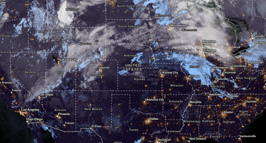
The latest weather forecast warned of a first major storm on the West Coast and Pacific Northwest, bringing challenging weather conditions. Heavy rain and snow are likely to unload.
The Pacific Northwest and Western US experienced heavy rains and snow conditions in the first week of November. The rain has become helpful with the prolonged dry and drought conditions in the region.
Quieter weather the next two days gives way to periodic precipitation chances Thu night to early next week. The mountains will have the highest risk; there may some moderate snow going into later this week & weekend in the Cascades, especially Washington Pass. #wawx #idwx pic.twitter.com/7AYONQG5kk
— NWS Spokane (@NWSSpokane) November 8, 2023
The fall weather began the cooler outlook in parts of the US. While hurricane season is over, forecasts warned of possible storms and witch storms in November.
Rounds of Storm, Snow to Hit West Coast Next Week

The National Weather Service (NWS) monitors the developments of an upper trough over the west-central US. It can bring snow showers and rain in portions of the Northern Rockies and the Pacific Northwest.
The rainy outlook will unload in the midweek or Thursday. In this week's weather dangers, homeowners should watch out for the following:
- Heavy snow in high-elevation areas
- Small to severe flooding
- Landslides and flash floods
- Travel dangers
Travel difficulties could happen due to a mixture of snow and rain. Motorists should check the forecasts before planning outdoor activities in the Pacific Northwest and West Coast.
In the latest forecasts, meteorologists warned of a potential first major storm on the West Coast. The region experienced prolonged drought, and the rain will benefit drought-stricken areas, especially in Western Washington and Oregon.
In the late week, residents can anticipate heavy rains and localized flooding. The stormy conditions are forecast in the following areas:
- Spokane
- Yakima
- Medford
- Redding
- Spokane
- Northwest California
In Los Angeles, the forecast showed that wind gusts could reach from 20 to 45 mph. 55 mph winds are also possible. With strong winds and humidity drops, fire dangers can occur.
Furthermore, the chance of snowflakes is likely in higher areas, including in the Rockies in Idaho, the Cascades and the Olympic Mountains. Campers should check for hiking dangers and advisories.
However, the next week's weather will bring significant rainfall to the West Coast. The areas at risk are the following:
- Seattle
- Spokane
- Helena
- Boise
- Portland
- Medford
- Redding
- Reno
- Elko
- San Francisco
- Fresno
- San Diego
Residents should stay alert for the weather and strong winds. Low-lying areas are at risk of small to severe flooding.
West Coast Rainy Outlook: How Can People Stay Safe?
The West Coast and the Pacific Northwest are expected to experience the threats of heavy rains next week. As a result, weather preparedness is essential to avoid weather dangers next week.
Homeowners should avoid flooded areas as much as possible. When the weather worsens, staying at home is a recommended choice. In addition, immediate evacuations are crucial when floodwaters rapidly rise.
Did you know? The Hurricane season has come to an end. However, powerful tornadoes can also threaten this November.
Related Article : Freezing Rain, Snow to Hit New York City, Parts of Northeast This Midweek, Forecast Shows
For more similar stories, don't forget to follow Nature World News.
© 2025 NatureWorldNews.com All rights reserved. Do not reproduce without permission.


