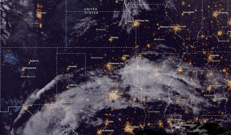
The latest weather forecast warned of intense rainfall and thunderstorms from Southeast Kansas to Northwest Texas this week. The rain can likely cause possible flooding and flash floods.
October's final week has brought frost and freeze warnings in areas of Ohio Valley, Central and Southern Appalachians.
Meanwhile, the snow is also expected to return to the Cascades this early week. In Northeast and New England, Americans can anticipate stormy conditions.
Here are tonight's SE TX area expected low temps & an outlook for the upcoming week. Look for periods of showers & possible thunderstorms with the best chances currently expected in the Wed-Thu time period. It will be staying warm and muggy. #txwx #houwx #glswx #bcswx pic.twitter.com/YBDBAc5Np8
— NWS Houston (@NWSHouston) October 22, 2023
However, the threat of rainfall will fall on parts of Southeast Kansas and Northwestern Texas, including in South-Central US. Homeowners should check the weather in Kansas and Texas.
Southeast Kansas and Northwest Texas: Where Will Rain Impact?

In this week's forecast, the main weather dangers are heavy rain, flooding, flash flooding, travel disruptions due to flooded roads, urban flooding and damaging winds.
According to the latest advisory (October 22), the National Weather Service (NWS) reported that heavy rain conditions could unload in portions of Texas and the Edwards Plateau and Rolling Plains on Monday.
In addition, Southeast Kansas to Northwest Texas can expect threats of intense rains and scattered flash flooding in the early week. Homes in low-lying or flood-prone areas can be at risk of small to severe flooding depending on the rain intensity.
The upper-level low in Northwest Mexico could help with the thunderstorms in the Southern Plains. Possible severe storms could also unload in portions of the Midwest and Upper Great Lakes.
Although scattered, mainly light rain is forecast in some areas Monday and Tuesday, we're watching for the potential for storms and heavier rains Wednesday and Wednesday night. Shown are the current chances for >1" of rain through 7am Thursday. Isolated flooding is possible. pic.twitter.com/rMjGaRdqyy
— NWS Austin/San Antonio (@NWSSanAntonio) October 22, 2023
Currently, the NWS is monitoring the developments of Tropical Storm Norma over the Southern Gulf of California. In West Texas and New Mexico, the latest forecast showed that rainy conditions could unfold this week.
From Monday to Thursday, residents can expect a wet weather outlook in the following areas:
- Oklahoma City
- Lubbock
- Dallas
- Austin
The good thing about the rain will ease the prolonged drought in the regions, especially in Memphis, Houston, and Dallas. South-Central States in the US have experienced dry conditions due to a lack of rainfall and high temperatures.
In Houston, the advisory said that thunderstorms and showers are expected this early week. The weather can offer cooler temperatures.
Meanwhile, light rains will hit portions of Austin and San Antonio. The rain will intensify on Wednesday.
Also Read : Light Rain to Unload in Central California, Pacific Northwest This Weekend As Cooler Air Comes Next Week
How To Keep Safe From Flash Flood Risk, Intense Rainfall
The advisories warned of flash flooding and intense rainfall in parts of South-Central States. Heavy rains and flash flood risks can be life-threatening, especially for motorists. As a result, weather preparedness is crucial to prevent potential damages or injuries.
Here are essential reminders for motorists in Kansas and Texas this week.
- Homeowners should check for flooded roads and travel delays to avoid being stranded while on the roads.
- When the rain intensifies, it is best to stay at home until it becomes better.
- Preparing emergency kits will be helpful during severe weather conditions, especially when winter is coming.
Related Article : US Weather Forecast: Stormy Conditions, Travel Delays to Hit Northeast, New England This Weekend
For more similar stories, don't forget to follow Nature World News.
© 2025 NatureWorldNews.com All rights reserved. Do not reproduce without permission.


