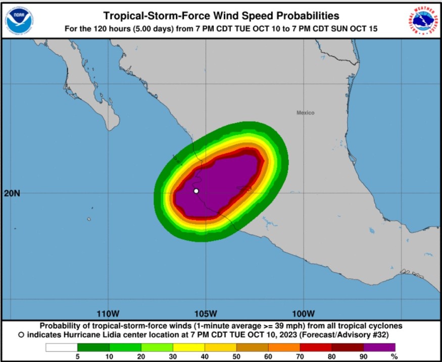
Meteorologists said that Lidia hit Mexico as a hurricane and it is still forecasted to continue to push inland.
They said that Lidia has intensified to Category 4 hurricane strength with winds of 140 mph (225 km/h) as it churned about 110 miles (175 km) off the coast of Puerto Vallarta, Mexico.
It has maintained the same intensity until it made landfall early Tuesday evening near Las Penitas in the state of Jalisco.
Furthermore, on late Tuesday evening, Lidia began to lose wind intensity over land as sustained winds decreased to 105 mph (170 km/h).

Track
The National Hurricane Center and Central Pacific Hurricane Center said that at 100 AM CDT (0600 UTC), the center of Tropical Storm Lidia was spotted inland near latitude 21.7 North, longitude 103.5 West.
Lidia is moving toward the northeast near 21 mph (33 km/h). This general motion at a slightly faster forward speed is expected today.
Meanwhile, on the forecast track, the center of Lidia will continue moving inland over west-central Mexico this morning. The hurricane's motion is estimated to be 60/15 kt.
Lidia is expected to accelerate northeastward in the flow of a mid- to upper-level trough located over northern Mexico.
It is said that Lidia's maximum sustained winds have decreased to near 70 mph (110 km/h) with higher gusts.
Rapid weakening is expected today as Lidia continues moving inland. Tropical-storm-force winds extend outward up to 140 miles (220 km) from the center.
Weather experts said that estimated minimum central pressure is 994 mb (29.35 inches).
When it comes to rainfall, Lidia is expected to produce rainfall totals of 4 to 8 inches with local maxima of 12 inches through today across the state of Nayarit, southern portions of the state of Sinaloa, and coastal portions of the state of Jalisco in western Mexico.
These rains will likely produce flash and urban flooding, along with possible mudslides in areas of higher terrain near the coast.
On the part of storm surge, water levels along the coast of west-central Mexico will gradually subside overnight.
Tropical storm conditions, meanwhile, are occurring in portions of the tropical storm warning area.
Surf swells from Lidia is also seen to affect the west coast of Mexico and the Baja California peninsula through today. These swells are likely to bring life-threatening surf and rip current conditions.
Residents are advised to consult local weather offices for the latest advisory.
Read Also : Tropical Storm Lidia Expected to Intensify into Hurricane, Threatens Mexico With Rough Surf
Seasonal first
Weather experts said that Lidia's landfall marks a seasonal first for Mexico.
They pointed out that not only did Lidia make landfall as the first major hurricane of the season in Mexico, but no other systems have hit the country as a hurricane this year.
Meteorologist Jesse Ferrell said that Hurricane Beatriz never made landfall, but it came within 25 miles of the Mexico coast on July 1.
On the other hand, Hilary was a tropical storm when it made landfall on August 20 on the northern part of Baja California Peninsula.
Related Article : Warm Waters Of Gulf Of Mexico Could Give Birth To New Tropical System
Related Video:
© 2025 NatureWorldNews.com All rights reserved. Do not reproduce without permission.


