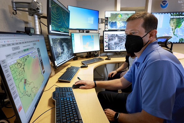
Recent weather updates showed that Tropical Storm Karl could unleash torrential rain and strong winds in parts of Mexico, especially the south-central coast starting late Friday.
Residents nearby should stay updated with the weather and listen to the announcement of their local authorities.
Based on the National Hurricane Center's recent update on October 12, (10:00 p.m, CDT) said that tropical conditions could occur in Mexico.
Tropical Storm Karl Advisories

Karl is expected to strengthen by the next day and gradually weaken.
The National Hurricane Center said Tropical Storm Karl was tracked about 170 miles (275k) east-northeast of Tuxpan, Mexico, moving at six mph (9 km/h) to the north-northwest.
The advisory noted that Tropical Storm Karl showed a maximum wind of 45 mph (70 km/h) with higher gusts based on the Air Force Research Hurricane Hunter's data.
The report Karl's tropical-storm-force winds are expected to extend up to 105 miles (165 km) from the center and have a minimum pressure of 29.64 inches.
Moreover, the National Hurricane Center noted that Karl would begin a slow drift to the west and west-southwest later this morning.
Forecasts added that the tropical storm could move faster toward the south-southwest.
The potential threat of Tropical Storm Karl could cause flooding, rainfall, and possible mudslides.
According to NHC, Karl could cause flooding up to three to seven inches with a forecasted local maximum of up to 12 inches of rains over the portions of Tabasco states, Veracruz starting Friday night, raising concerns of flash flooding in higher terrains.
Starting Thursday night, Tropical Storm Karl could bring winds with tropical storm conditions to the Mexican coastline.
Ships and boats should be careful and check the weather forecasts, as the storm could result in life-threatening surf in the next few days.
Tropical Storm Karl is recorded as the 11th storm of the Atlantic Hurricane Season, which forecasts monitored last week and formed as an organized storm over the Bay of Campeche.
Meanwhile, AccuWeather said that Tropical Storm Karl is rated less than one on the Mexico AccuWeather RealImpactTM Scale for Hurricanes.
In the website's recent report, AccuWeather showed that Tropical Storm Karl could result in flash flooding, locally damaging winds, mudslides, rip currents, and rough surfs, noting that the storm would not pose a threat to the United States.
Tropical Storm Safety
According to the reports, Tropical Storm Karl would bring torrential rains, causing flash flooding, mudslides, and localized floods.
Although forecasts noted that Karl's possibility of becoming a hurricane is low, it would still cause dangers.
Here are some important reminders before the tropical storm makes landfall.
Local weather forecasts
Keep updated with the local reports from your community. Stay alert to the tropical storm watch or warnings and flooding threats. Fully charge your mobile phones and prepare a power bank in case of power interruptions.
Check your home
Hurricanes are capable of wreaking havoc, causing massive damage to homes. Check your homes for the storm's potential impact on the roof and windows. If your house is flood-prone, evacuate your appliance to higher areas
Check your home
Refrain going outdoors
The storm could make zero visibility on major roads, turn down trees and power lines, and flood roads. As much as possible, refrain from traveling outside and reschedule appointments.
Related Article : Hurricane Ian Devastates Citrus Grower's Florida, Causing Crop Losses
For more similar stories, don't forget to follow Nature World News.
© 2025 NatureWorldNews.com All rights reserved. Do not reproduce without permission.


