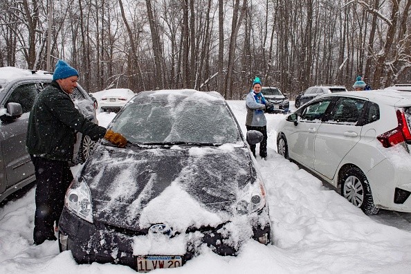
AccuWeather meteorologists are keeping a close eye on a major storm that is expected to emerge by the end of the week, bringing heavy rain, powerful thunderstorms, high winds, snow, and rapid freeze throughout the eastern third of the US.

Areas to Experience Snow, Rainfall
AccuWeather Meteorologist Alex DaSilva indicated that the likelihood of a major storm with wide-reaching effects is increasing.
End of week storms will form in the central Gulf Coast when Arctic air dives southward and collides with warm, moist air across South.
A north-northeastward path is predicted for the storm from there, following the cold front. It will arrive just a few days after a swath of snow blankets the Central states from Wednesday to Thursday as well as the mid-Atlantic and New England, as per AccuWeather.
This cold air's path south and east will have a significant impact on the storm's specific path and the locations of the rain and snow bands.
AccuWeather Senior Meteorologist Alex Sosnowski said that eastern Oklahoma, the western parts of Ohio, Kentucky, and Tennessee, and even the northern regions of Mississippi and Alabama have a chance of getting a few inches of snow.
This year's storms are expected to bring snow and sleet to the roads even during the daytime hours because of the increased March sun angle.
Residents of the southern Plains may be taken aback by the return of wintry weather after a midweek cooling down period. During a 24-hour period, temperatures might fall 30 to 50 degrees Fahrenheit due to the arrival of cold air.
Weather in Dallas is expected to warm back up on Thursday, but temperatures will plunge into the 30s on Friday due to rain, sleet and snow, Sosnowski said. Dallas last saw measurable snowfall in March (0.10 inch or more) in 2015.
Also Read: Storms Dudley and Eunice Left Dolphins, Other Mammals Stranded and Dead Along Welsh Beaches
The Storm May Attain the Bomb Cyclone Status
After starting out as rain, the precipitation might turn to snow Friday night for regions as far south as Birmingham, Alabama, according to DaSilva's forecast.
The storm is forecast to rapidly grow as it moves north-northeast toward the Eastern Seaboard during the weekend, possibly becoming a bomb cyclone. When this type of strengthening occurs, the most common effect on the ground is strong winds.
This weekend, forecasters predict that this is exactly what will happen across the East Coast, among other weather hazards.
According to DaSilva, wind gusts could cause extensive power disruptions over the Northeast and mid-Atlantic on Saturday and Saturday night. Branches that were weakened by a line of heavy rain that moved from the central Appalachians to southeast New England on Monday are of particular concern, according to forecasters.
The storm is expected to make landfall in New England on Saturday, but the good news is that it will approach at low tide. There may not be as much risk of coastal flooding because of the storm.
Possible Travel Delays Due to the Severe Weather
AccuWeather meteorologists say the precise timing of the entry of colder air will be critical in determining whether regions receive heavy snow, rain transitioning to snow, or all rain before precipitation abruptly ends in the Northeast.
While there's still a lot of the storm left, Sosnowski is worried about how much cold air will be racing eastward into the Appalachians.
At the onset of precipitation, or as temperatures drop dramatically during the event, the air will be cold enough for mostly snow to fall, with accumulations ranging from a few inches to a foot or more, Sosnowski said.
A fast drop in temperature could generate widespread slippery conditions even if the precipitation stops before the cold air rushes in and causes the conversion to snow, according to forecasters.
According to DaSilva, even if it rains most of the day Saturday along the I-95 corridor, a flash freeze is likely to ice the wet roads. There are expected to be severe delays on both land and air this weekend for travelers in the region. Due to fallen trees and electrical lines, some roads may be unusable.
Meteorologists at AccuWeather will also be on the lookout for severe weather on the storm's southeast flank.
Related Article: Developing Storm System and Cold Front to Cause Strong Winds, Winter Storm, and Torrential Rain Across the US
For more news, updates about storms and similar topics don't forget to follow Nature World News!
© 2025 NatureWorldNews.com All rights reserved. Do not reproduce without permission.


