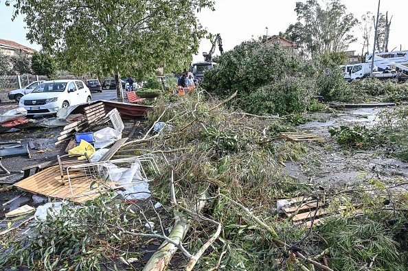
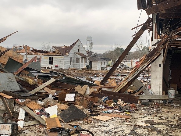
In the last days of 2021, another round of severe weather might be delivered to parts of the central and southern United States, less than three weeks after a record tornado outbreak ravaged the areas.

Stormy Weather to Develop Across Central and Eastern US
AccuWeather meteorologists are keeping a close watch over a developing storm moving across Midwest. A vast region of the central and eastern United States is expected to be battered by storms in the coming days, according to Accuweather.
Despite the possibility of snow in the Upper Midwest and Great Lakes, a separate threat will begin to materialize in the southern United States on Tuesday night.
By midweek, an oversupply of warm, moist air from the Gulf of Mexico is expected to reach the southern United States.
Matt Rinde, senior meteorologist at AccuWeather, predicts that moisture will move northward into Louisiana, Arkansas, Mississippi, Alabama and maybe Tennessee on Wednesday and might extend farther into the southern Appalachian Mountains on Wednesday night.
Combined with extremely warm temperatures currently in place throughout most of the South, this copious moisture may lay the ground for some explosive growth.
Regions in the Path of Potentially Severe Storms
For many regions, numerous rounds of rain and thunderstorms are anticipated to begin Tuesday night and continue through Wednesday night.
Rinde warned that flash floods and severe winds would be the major dangers of these storms.
There will always be a threat of heavy rain as a thunderstorm approaches. Flash floods may be deadly for anybody caught in their path if too much rain falls too soon.
Locally severe gusts of 50-60 mph may accompany heavy rains in any storm that is powerful enough. Winds of this strength may destroy trees and even power lines. . As a result, midweek power interruptions cannot be ruled out.
Cities including Nashville, Tennessee; Louisville, Kentucky; Birmingham, Alabama; and Atlanta, Georgia are expected to be hit by these ferocious storms. From Tuesday night into Wednesday night, motorists on sections of Interstates 20, 40, 55, and 65 should be on the lookout for quickly shifting weather conditions.
This week, forecasters believe that the highest danger for extreme weather will be concentrated in parts of the Gulf Coast states. During Wednesday's severe weather, the bull's-eye is expected to be centered over Mississippi and Alabama, where atmospheric conditions may be the ripest.
Hail, devastating wind gusts of more than 60 mph, and torrential rain are all possibilities during a severe thunderstorm.

Impacts of Tornado Outbreak
At least 92 people were killed in a massive tornado outbreak just over two weeks ago, according to the AP. This fresh warning for severe weather arrives just in time.
At least 66 tornadoes were verified during the event, which took place on December 10 and 11. Dr. Joel N. Myers, founder and CEO of AccuWeather, estimates that the tornadoes would cause damage and economic loss of $18 billion.
Restoration work is ongoing, particularly in areas like Mayfield, Kentucky where the damage was substantial. Cleanup activities are ongoing. Many people lost their homes, businesses, and infrastructure to the most powerful storms that struck the area.
However, forecasters will keep an eye on a current storm track that might lead to a far more powerful system in the eastern United States as the year 2022 approaches, even after this storm has passed.
Related Article : Severe Thunderstorms Ripped Across Southern United States, Prompting Tornado Warnings
For more news, updates about storms and similar topics don't forget to follow Nature World News!
© 2025 NatureWorldNews.com All rights reserved. Do not reproduce without permission.


