Despite the fact that it's now December, the severe weather season has not yet passed for some residents in the southern United States.

Possible Tornado Touched Down Louisiana
The threat of severe weather, more similar to spring than early December, will continue across some parts of the southern US Monday, according to AccuWeather forecasters.
While December will bring more winterlike weather to certain parts of the nation, severe weather is predicted to return to others, including most of Arkansas and western Tennessee, according to AccuWeather Meteorologist Lauren Hyde.
Early this week, a cold front connected with a powerful storm that is expected to dump snow over parts of the Upper Midwest, Great Lakes, and Canada will reach south and dig into the southern tier of the United States, according to Accuweather.
On Sunday, severe storms began to intensify, with reports of quarter-sized hail ranging from Arkansas and Oklahoma to Kentucky and Tennessee. In Jonesboro, Illinois, gusts of up to 65 mph were observed. On Sunday night, a tornado warning was issued for central Jackson County, Illinois, while a tornado was reported in Livingston County, Kentucky.
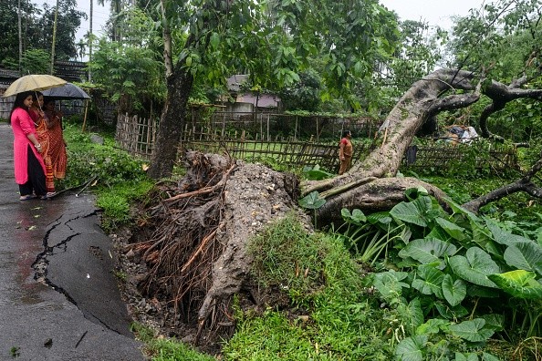
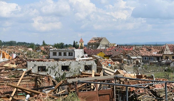
As per the Storm Prediction Center (SPC), massive trees collapsed in Slagle, Louisiana, as a possible tornado impacted the region on Monday morning.
Thunderstorm activity over the Mississippi Valley is anticipated to continue on Monday, AccuWeather Meteorologist Alyssa Smithmyer said. On Monday, atmospheric conditions in parts of the southern Plains and Southeast will be favorable for a few strong storms.
Also Read : Meteorologists: Storms Could Possibly Prompt Flooding and Wind Threat in North-central US
Areas at Risk for Feisty Storm
Early this week, storms will threaten areas ranging from eastern Texas through parts of Louisiana and Arkansas, as well as most of Kentucky. Houston, Nashville, Tennessee, Louisville, Kentucky, and Cincinnati will have to keep an eye on the sky for shifting weather.
Hail and severe winds are predicted to be the major risks from these storms, however an isolated tornado cannot be ruled out, Hyde said.
Forecasters said that although isolated tornadoes cannot be fully ruled out anywhere in the regions at risk for severe weather, they have identified a more specific area where additional measures may be necessary.
On Monday, isolated tornadoes are expected in areas ranging from eastern Texas through northern Louisiana and southern Arkansas to Mississippi and northwestern Alabama, including towns such as Shreveport, Louisiana, Jackson, Mississippi, and Lufkin, Texas.
Damageable winds may gust to 50-60 mph in the fiercest storms, with an AccuWeather Local StormMaxTM of 75 mph.

Storm to Bring Heavy Rainfall to Some Areas
Winds this strong have the potential to knock down trees and electrical lines. Because power outages could possibly occur, people should make sure all gadgets are charged and ready before storms hit.
Any potent storm, in addition to hail, wind, and occasional tornadoes, has the ability to produce significant rain. Any of these severe downpours might result in flash floods, particularly in low-lying or poorly-drained regions.
On Monday, downpour, perhaps catastrophic storms will continue to hit parts of Louisiana and Mississippi. Forecasters advise everyone who has to travel to allow more time and have alternate routes planned in case of flooded roads.
Many inhabitants may believe that the severe weather season has ended by early December, with the customary peak of activity being in the spring. However, the severe weather season typically has a secondary peak in the autumn months.
Related Article : More Than 25,000 Remain Without Power in Rochester Region after Thunderstorms Move Through Area
For more news, updates about storms and similar topics don't forget to follow Nature World News!
© 2025 NatureWorldNews.com All rights reserved. Do not reproduce without permission.


