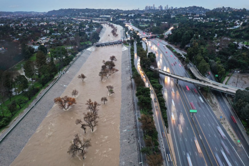
The Pacific Northwest and Northern California are bracing for a series of storms set to bring significant rainfall over the coming week.
Known as atmospheric rivers, these narrow streams of moisture in the sky will deliver quick, back-to-back rain events. While each storm is expected to be moderate in strength, their cumulative impact could disrupt holiday travel and increase the risk of flooding.
Atmospheric Rivers Bring Heavy Rain and Flood Risks to Pacific Northwest
Meteorologists forecast multiple atmospheric rivers hitting the region, particularly Washington, Oregon, and far Northern California. The Olympic Peninsula and areas in Northern California could see up to 14 inches of rain over the next seven days.
According to The New York Times, major cities like Seattle and Portland are expected to record around 3.5 inches each, while San Francisco may receive about 1.5 inches. Southern California, however, is likely to remain mostly dry, with only a slight chance of light rain around Christmas Eve.
Although the storms are not expected to linger, their rapid succession could cause waterways to swell, with many rivers in Washington and Oregon at risk of flooding.
These systems will also bring heavy precipitation to mountainous areas like the Cascades and the Olympic Mountains, where rainfall totals could exceed 10 inches. Higher elevations are likely to experience wet, dense snow, particularly as temperatures drop midweek.
Travelers are urged to stay informed about weather conditions, especially during Christmas Eve and Christmas Day. Mountain passes in the Cascade Range and Sierra Nevada may see hazardous conditions due to rain or snow, complicating road travel.
Coastal areas face additional risks, with large waves and dangerous surf expected along Northern California and Oregon's shores. Some swells could reach up to 30 feet, potentially causing localized coastal flooding.
Read more: Antarctica's Deception Island: A Volcano-Formed Sanctuary in the Heart of the Southern Ocean
Atmospheric Rivers Deliver Rain, Snow, and La Niña Effects to California
Atmospheric rivers act like atmospheric highways, transporting vast amounts of water vapor from tropical regions to higher latitudes. When these streams encounter land or mountain ranges, they release moisture in the form of rain or snow.
While common during the winter, these systems often bring warmer conditions, raising snow levels to 8,000 feet or higher. However, cooler temperatures later in the week could bring snow to elevations as low as 6,000 feet.
The wet weather aligns with La Niña, a climate pattern associated with cooler-than-normal Pacific Ocean waters. This phenomenon has resulted in a stark wet-dry divide across California.
Northern areas, including Sonoma County, are on track for a record-wet start to the water year, while Southern California experiences its driest start on record, The Washington Post reported.
With at least five atmospheric rivers forecast through the week, experts emphasize the importance of preparation. While none of the storms are expected to be extreme individually, their combined effects could lead to serious flooding in some areas. Meteorologists encourage residents and travelers to monitor forecasts closely and exercise caution in flood-prone or mountainous regions.
© 2025 NatureWorldNews.com All rights reserved. Do not reproduce without permission.


