Northeast and Midwest can expect possible tornadoes, and very large hail, according to weather reports. A severe weather potential can lead to slower commutes and power outages.
An NWS Weather Prediction Center forecast also monitors widespread storms that could unleash damaging winds, tornadoes, and flash floods in New England. Additionally, stormy conditions are likely in the Upper Midwest on Monday.
As June ends, homeowners can expect challenging weather conditions in parts of the U.S. due to tropical developments, and severe thunderstorms. The primary risks are flooding, heavy rains, large hail, thunderstorms, and isolated tornadoes.
Weather Outlook in the Northeast and Midwest: Where Will Stormy Conditions Hit?
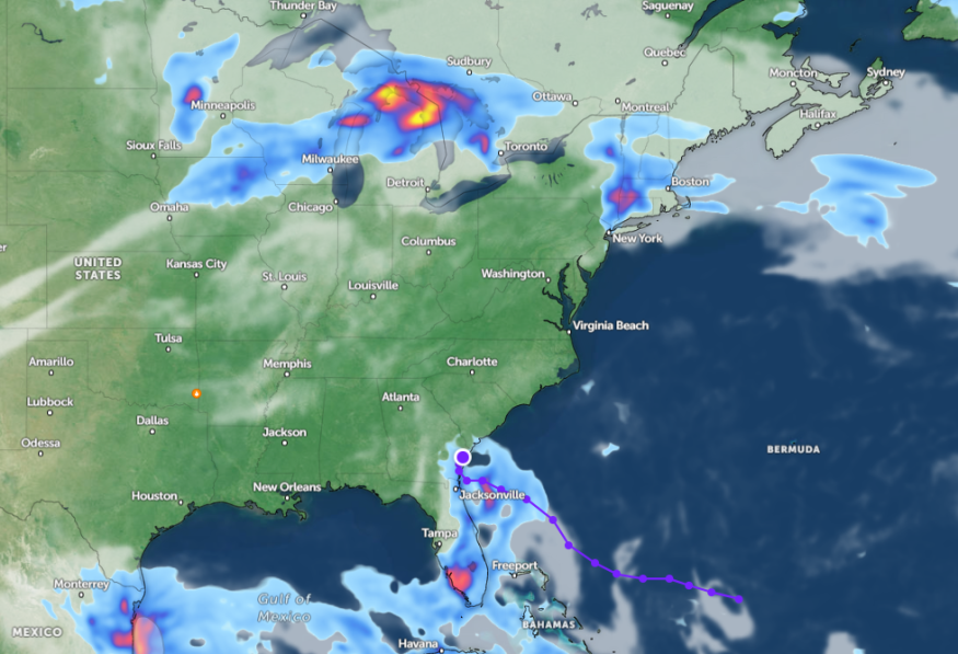
According to a weather report published on June 23, the latest advisory raised concerns about possible heavy, and severe storms in Midwest and Northeast. Communities in flood-prone areas can experience potential flooding and flash flood concerns this week.
Heavy rains and thunderstorms can unload from Maine to Kentucky. People with travel plans should monitor the weather and road conditions to avoid travel hazards this week.
Severe thunderstorms are forecast to bring isolated tornadoes, flooding rain, and localized damaging wind gusts. A poor weather outlook can likely unfold in New York, Boston, Portland, Burlington, Pittsburgh, Buffalo, Nashville, and Charleston.
For New York residents, there is a chance of hotter weather conditions and the return of strong to severe thunderstorms. The advisory warns of possible impacts of severe thunderstorms, including tree damage and travel disruption.
On Monday, the severe thunderstorms can affect the following areas:
- Fargo
- Sioux Falls
- Duluth
- Marquette
- Green Bay
- Minneapolis
A recent weather advisory in Duluth shows showers and a few thunderstorms are expected in the region, with possible highs in the 70s. Flooding concerns are likely in areas near rivers, such as the St. Louis River in Scanlon and Vermilion at Crane Lake.
On Tuesday, severe thunderstorms can bring hail and flash floods. Areas at risk are the following:
- Des Moines
- Kansas City
- Peoria
- St. Louis
- Chicago
- Indianapolis
- Green Bay
- Detroit
In Pittsburgh, residents should watch out for thunderstorms and showers this week, which could unleash damaging winds and locally heavy downpours. For Boston residents, the active weather outlook can cause severe weather potential, affecting portions of western-central Massachusetts.
In addition, Chicago can anticipate a line of slow-moving thunderstorms, which will help with instances of flash floods and heavy rains. Northern Illinois and northwestern Indiana can experience heavy rains, including in the I-88 corridor and Wisconsin.
The severe thunderstorms can stay until Wednesday, bringing challenging situations in the following areas:
- Kansas City
- Des Moines
- Peoria
- Chicago
- Indianapolis
- Green Bay
- Detroit
Weather Preparedness in the Midwest and Northeast Due to Severe Weather Conditions
As severe thunderstorms continue to impact parts of the country this astronomical summer, homeowners should keep updated with the latest weather advisories and information. Checking for tornado concerns is helpful to mitigate the risks.
For more similar stories, don't forget to follow Nature World News.
© 2025 NatureWorldNews.com All rights reserved. Do not reproduce without permission.


