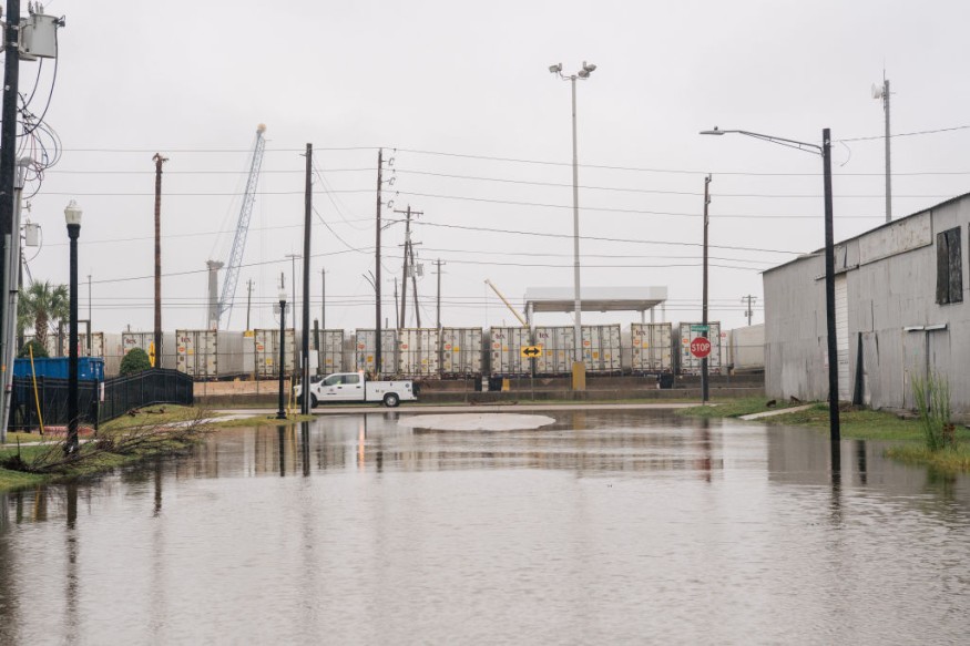
According to a weather report, challenging weather conditions are expected in Texas and Louisiana this week. The forecast warns of heavy downpours and flash flood risks, resulting in travel delays.
June recorded severe weather conditions in the south-central U.S., resulting in flooding and flash flood risks. Isolated tornadoes also occurred that caused significant damage to lives and properties.
According to a weather report by the NWS Weather Prediction Center for June 15 to June 22, the 7-day precipitation forecast reports excessive rainfall in the western and central Gulf Coast.
In addition, multiple rounds of severe thunderstorms are forecast in the northern and central U.S. this week. Considering the weather conditions in parts of the country, commuters should stay updated with the latest forecasts before traveling.
Texas and Louisiana Weather Outlook: Where will severe thunderstorm outlook unload?
In the central Gulf Coast, the forecast is monitoring the development of a plume of tropical moisture. Additionally, Texas and Louisiana can experience potential heavy downpours and flooding concerns.
According to a weather report published on June 16, the latest weather report shows significant flooding, mudslides, and poor peach conditions can unfold over the southwestern Gulf of Mexico.
On Monday, tropical rainfall is likely this week. A poor weather outlook is expected in the following areas:
- Dallas
- Jackson
- Corpus Christi
- Houston
- Little Rock
- Brownsville
In Houston, the advisory shows a wet week in the region. From Monday to Wednesday, a chance of showers and thunderstorms is likely this week. Heavy rain potential is forecast for Tuesday, including street flooding.
A significant heat risk can be unloaded this week in portions of Arkansas due to an upper level of high pressure for Little Rock. Travelers should drink plenty of water and limit prolonged exposure to hotter weather conditions.
The report noted possible strip currents and rain potential in Houston, Laredo, Victoria, Alexandria, and New Orleans from Sunday to Thursday.
In a precipitation outlook for June 20 to June 24, NWS Austin / San Antonio reports potential moisture in the Gulf of Mexico and South-Central Texas next week. Additionally, the forecast shows that slightly above-normal temperatures will occur this week. However, there is a chance of showers and thunderstorms in late week.
Texas and Louisiana Weather Outlook: How can people stay safe from challenging weather conditions?

According to the weather reports, poor weather conditions are likely in Texas and Louisiana this week, including in the central Gulf Coast. With the weather conditions, it is best to stay at home until the weather finally becomes better.
Checking the road conditions and forecasts is advisable for commuters to stay safe from weather conditions. Additionally, homeowners should store emergency kits.
For more similar stories, don't forget to follow Nature World News.
© 2025 NatureWorldNews.com All rights reserved. Do not reproduce without permission.


