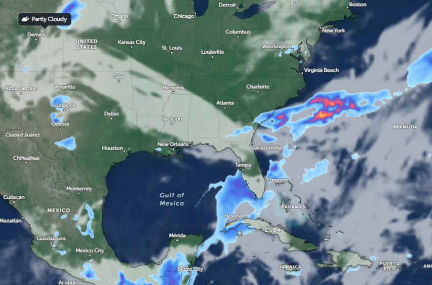
A National Weather Service (NWS) report warns of possible severe storms in portions of Texas this week, bringing flash flood risk and flooding. People with travel activities or plans should carefully consider the weather to avoid potential road dangers.
In early June, parts of Texas and the Western US experienced unusual heat, which caused heat advisories and risks. Due to favorable conditions for fires to spread, wildfire risks were also reported.
Weather conditions are expected to improve in parts of Texas, potentially relieving recent intense heat. However, another concern for Texas residents is the return of severe weather conditions.
Weather outlook in Texas: Where will severe storms unload?

According to a weather report for June 11 to June 13, the latest weather report reveals potential additional storms in the Gulf Coast and portions of Texas this week. In Central Texas, there could be a risk of flash floods and rain showers.
Meanwhile, showers and thunderstorms are likely in the northern and central Plains this week. The forecast also monitors the development of a system in the Upper Midwest, which could bring potential storms and showers on Tuesday.
NWS Austin / San Antonio warns of isolated storm in Austin this week. The main concerns in the region are gusty winds, occasional lightning, and locally heavy downpours. Additionally, thunderstorm outflow is likely in the region, particularly over the Coastal Plains, and winds are expected to reach 30 to 35 mph in some areas.
In addition, an NWS Weather Prediction Center raised concerns over an excessive rainfall outlook for June 11 to June 13. From Florida to the Caribbean, there is a risk of flooding concerns.
This week, homeowners in the Texas Panhandle, South Plains, and North Texas should know about flash flood potential.
Weather in other portions of the USA
Another concern in other parts of the U.S. is an unusual heat and wildfire risk. An NWS report shows that well-above-average temperatures are likely in much of the West. Additionally, the forecast monitors the development of an upper-level high in northern Mexico and northern U.S.
Hotter temperatures are likely in the central California valleys, southern Nevada, Arizona, and southern New Mexico. According to the report, heat advisories are present in the affected areas, with temps likely to soar into the 100s and nighttime lows in the 70s.
Severe storms are likely in the southern Plains and lower Mississippi Valley. These severe storms are packed with strong winds, large hail, and flash floods in the south-central U.S.
On Tuesday, a severe thunderstorm potential is expected to hit the following areas:
- Amarillo
- Lubbock
- Odessa
- Wichita Falls
- Odessa
- Abilene
- Waco
- Austin
- Dallas
Due to potential weather risks, limiting outdoor activities is recommended in the affected areas. Homeowners should limit prolonged exposure to unusual heat for regions with a hotter temperature outlook.
For more similar stories, don't forget to follow Nature World News.
© 2026 NatureWorldNews.com All rights reserved. Do not reproduce without permission.


