Challenging weather conditions are expected in the Plains this weekend, according to a weather report. Residents can likely experience flooding, rainfall, and hail conditions.
In recent Nature World News (NWN) reports, portions of the Plains and the south-central U.S have experienced severe weather threats, especially isolated tornadoes.
For this week's weather, homeowners should keep alert for the latest weather information for any travel activities or outdoor plans. The primary risks are isolated tornadoes, hail, and heavy rains.
Plains Weather Outlook: Where will severe thunderstorms unload?
In the latest weather report, the forecast warns of severe thunderstorms in portions of the Great Plains. Residents should be extra cautious when traveling due to slippery commutes and other travel hazards.
There is also a chance of damaging winds and gusts, which can damage power lines and trees. Homeowners should prepare for power outages, and it is best to stay away from tree areas.
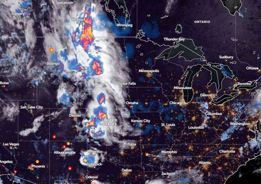
On Wednesday, commuters can experience the threats of severe thunderstorms, packed with hail and isolated tornadoes. The areas vulnerable to these risks are Billings, Rapid City, Kearney, Wichita, Oklahoma City, Lubbock, Corpus Christi, and Odessa.
The National Weather Service (NWS) issued an advisory on May 30. The forecast warns of severe thunderstorm potential in the southern and central Great Plains on Thursday or Friday. People are advised to watch out for severe winds and large hail.
On Wednesday, scattered strong storms will occur in the northern and central High Plains. As a safety reminder, commuters should check the road conditions to avoid hazardous travel.
On Thursday, severe thunderstorms can continue threatening Sioux City, Kearney, Wichita, Oklahoma City, Lubbock, and Dallas. Additionally, NWS Houston reports scattered thunderstorm risk this week. There is the likelihood of strengthening storms, causing frequent lightning and heavy rainfall.
People should monitor for potential hail, flooding rain, and localized damaging winds on Friday. These threats are likely in Oklahoma City, San Antonio, San Antonio, Houston, and Wichita.
Kansas City residents may experience rainfall on Thursday and Friday. Homeowners should be alert for localized flooding, particularly in low-lying or flood-prone areas. Heavy rainfall potential can hit eastern Kansas and western Missouri.
Severe thunderstorms can stay until the weekend. On Sunday, the risks can affect portions of Rapid City, Aberdeen, Sioux Falls, North Platte, Hays, and Fargo.
Read also: Northeast Weather Forecast: Much-Awaited Cooler Air to Bring Relief from Recent Intense Heat
Weather preparedness: how can homeowners stay alert for severe thunderstorms
Considering the weather outlook this weekend, people with travel plans should consider the forecasts to avoid potential road dangers. Additionally, limiting outdoor plans is advisable in the Plains and south-central U.S.
For homeowners, having emergency kits will be very helpful in challenging situations. Keeping emergency flashlights, medicine kits, batteries, battery-powered radios, and bottled water will help.
Read also: New York, Pennsylvania Weather Forecast: Heavy Rains Packed with Thunderstorms Likely This Week
For more similar stories, don't forget to follow Nature World News.
© 2025 NatureWorldNews.com All rights reserved. Do not reproduce without permission.


