The latest weather report shows that dangerous heat is expected in the southern U.S this week, indicating the arrival of summer in the country.
As many Americans traveled for Memorial Day weekend, the hotter weather outlook is likely to stay midweek. Some parts of the U.S. have experienced poor weather outlook due to severe thunderstorm threats.
According to a National Weather Service (NWS) report, thunderstorms and showers will likely impact portions of Ohio Valley into the Mid-Atlantic. The forecast warns of potentially locally heavy rainfall and isolated flash floods.
Although the warmer outlook can favor outdoor plans or activities, people should remain alert for challenging heat. Prolonged exposure to scorching temperature can lead to heat-related health risks, such as heat stroke and stress.
High temperatures in the Southern US next week: Areas a risk of intense heat

In a weather report published on May 26, the forecast reveals potentially extreme heat and humidity can unfold next week. Residents should keep alert for record-challenging heat, resulting in heat-related health concerns.
People with travel activities can anticipate a hot and humid outlook in the Southern U.S., showing the unofficial summer weekend. The scorching heat can put at risk vulnerable populations, including outdoor workers, people with medical conditions, outdoor workers, children, and older adults.
The weekend saw challenging heat, with highs reaching the 90s in some locations in the south. High temperatures were also reported in the Gulf of Mexico and the Florida Peninsula. There is a chance temperatures can increase 5 to 10 degrees above historical average.
According to a report by the NWS Southern Region, people are advised to be alert for signs of heat stroke and exhaustion. Commuters should stay in cooler areas and stay as hydrated as possible to prevent heat-related concerns.
Furthermore, an NWS Weather Prediction Center warns of significant early season heatwaves in the Gulf Coasts. On Monday afternoon, a hotter weather outlook is expected in the following areas:
- Lubbock
- San Angelo
- Corpus Christi
- Houston
- Dallas
- Jackson
- New Orleans
- Little Rock
- Jackson
- Tampa
- Miami
- Jacksonville
- Charleston
- Wilmington
Weather in other portions of the U.S.: Where will severe weather unload?
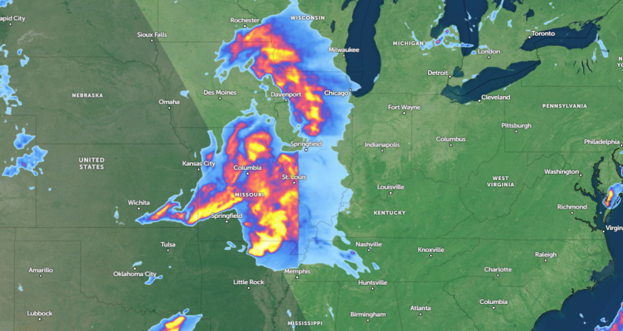
A weather advisory by NWS Short Range Public Discussion forecasts a severe weather outlook in the Ohio and Tennessee Valleys, including in the Mid-Mississippi, Mid-Atlantic, and Southeast.
In addition, the forecast monitors a possible storm system in the central U.S. this week, which could trigger thunderstorm conditions in Kansas, Missouri, Kansas and the Edwards Plateau of Texas.
Meanwhile, flash flood risks are forecast in Tennessee and Kentucky. In Southern Wiscon, there is a potential for heavy rain.
For north-central Texas residents, excessive rainfall is possible, including in Oklahoma.
Related Article: Central States Forecast: Destructive Tornadoes, Torrential Downpours Likely Midweek
For more similar stories, don't forget to follow Nature World News.
© 2025 NatureWorldNews.com All rights reserved. Do not reproduce without permission.


