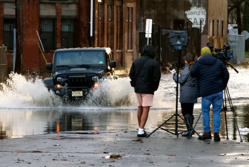
Weather experts warned that massive floods and power outage in remote areas are possible due to the storm that will hit northeastern United States.
Officials are already on alert for powerful winds and high floods in the region.
Following days of a previous storm that brought heavy snow in the interior Northeast and drenching rain on the middle portion of the Atlantic coast, a stronger and larger weather disturbance will hit the region with major impacts.
Power, Travel Disruptions
Authorities said that widespread power and travel disruptions as well as dangerous conditions to life-threatening conditions due to strong winds and high floods from Tuesday to Wednesday are expected.
The National Weather Service said that at present, the strong surface cyclone continues to rapidly deepen across the Texas and Oklahoma panhandles, noting that it is expected to continue to deepen as it crosses the Ozarks of Missouri before bottoming out in pressure across the Lower Great Lakes on early Wednesday.
Due to its depth, very strong winds are expected throughout the region with nearly the entire southern US and Appalachians into the northeast.
Authorities have already hoisted High Wind Advisories with areas already reaching warning criteria, in and near the surface low. The strongest winds will be felt along the Atlantic coast and over the ridges of the Appalachians.
Due to the bad weather, tree and property damage are very likely.
Authorities warned that large tree limbs could come crashing down on sidewalks, vehicles, homes and businesses without notice.
Moreover, trash cans and other unsecured items across communities and neighborhoods may become projectiles.
On the other hand, power outages could be long-lasting, especially in places that are considered to be remote as well as in other heavily wooded areas.
Furthermore, the strong winds have also brought above average temperatures and moisture up from the Western Gulf along or ahead of the eastward moving cold front currently in central Texas.
According to the forecast, this phenomenon will make for a very unstable day across the Gulf Coast region where severe weather is expected.
Meanwhile, flash floods could also be so significant that it may even pose a threat to lives in extreme cases.
Officials forecasted that much of the flash floods could take place after dark Tuesday night, which will add to the danger for motorists and other travelers.
Flooding problems will also extend well beyond areas where there is snow on the round and will go throughout the I-95 corridor of the mid-Atlantic and New England in cities from Washington, D.C., to Philadelphia, New York City, Boston and many others.
Read Also : Gulf Coast Weather Forecast: Nocturnal Tornadoes, Thunderstorms Likely in Northeast Texas, Mississippi Coast
Storm Brewing In Northwest
Based on forecast, the weather problems may be so severe on Tuesday night, adding that it could continue further into Wednesday morning.
While a major storm is brewing east, an equally deep and strong surface cyclone approaches the Northwest Coast as well.
At present, a warm front is on the doorstep of Washington and Oregon, with light rainfall and higher elevation flurries already overrunning the area.
After the warm front passage, strong winds with modest moisture will surge ashore, but as the low deepens, the cold front will quickly press through and crash snow levels.
Related Article : Widespread Snowstorm in Northeast, New England: Flooding, Damaging Winds Likely This Week
© 2025 NatureWorldNews.com All rights reserved. Do not reproduce without permission.

