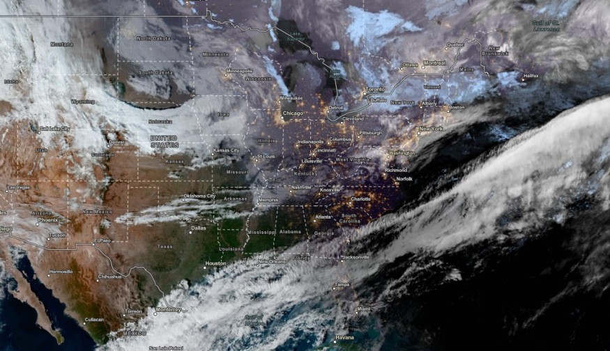
The latest weather forecast showed that increasing winds and flooding rain are likely in the Northeast this week, causing flooding concerns and travel disruption.
The National Weather Service (NWS) reported that precipitation is likely in the Southern Plains and eastward Northeast Coast. Meanwhile, the agency is monitoring an East Coast storm and lake-effect snow in the Great Lakes on Wednesday.
In the Northeast, the forecast warned of flooding concerns and heavy rain in the region. The stormy outlook will unload in the New England and Mid-Atlantic in the early week.
In this week's weather, the main concerns are localized flooding, strong winds, heavy rain and power outages. About 3 to 4 inches of snow is possible in the midweek.
Weather in the Northeast

In the midweek, the rainfall concern is likely in the following areas:
- Quebec
- Montreal
- Bangor
- Portland
- Moncton
- Bangor
- Portland
- Boston
- Albany
- New York City
- Washington
- Charleston
- Virginia Beach
The flooding threat can also spread over Vermont and New Hampshire. Coastal hazards are also likely. The additional concerns are flash flooding and strong winds that can damage power outages and downed trees.
According to FlightAware.com, at least 100 flights were affected in the Northeast. Motorists should also check the travel conditions in the region, especially in New York City and Boston.
NWS Weather Prediction Center warned of excessive rainfall in Southern New England. Homeowners should anticipate high rainfall rates and moderate flash flooding.
Weather in Other Parts of the US: What Can People Anticipate?
A recent report showed that the holiday season in the US can become busiest for Americans traveling via train and land. Millions of Americans are expected to travel on the holiday.
Homeowners should prepare earlier their travel plans this December, especially for airlines. The challenging weather, from snow and rain, can cause travel disruptions.
On Wednesday, light snow will be likely in parts of the Rockies. Northwestern US can experience flooding concerns due to the heavy precipitation outlook.
In Southern California, residents should check for Santa Ana winds this early week. The strong winds will damage trees and power lines, increasing fire risks are also possible due to warm conditions and dry vegetation.
Wind gusts can reach from 30 to 40 mph in Southern California. Elevated fire risks are likely in Santa Clarita, Oxnard, San Bernardino and Temecula. The challenging winds can also damage light vehicles in California.
Homeowners should stay updated with the weather this midweek in the US, especially for Americans with outdoor and travel plans.
Related Article : Colder Temperatures, Travel Disruption To Hit Northeast This Weekend Due to Snowy Outlook
For more similar stories, don't forget to follow Nature World News
© 2025 NatureWorldNews.com All rights reserved. Do not reproduce without permission.


