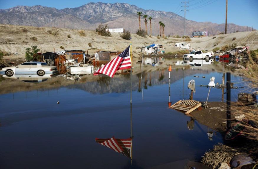
Experts said that the El Niño phenomenon could bring more floods across cities along the western coasts of the United States this year.
They said that these massive floods could fill roads and buildings in the said area.
Stronger El Niño
Based on the information given by the Climate Prediction Center, there is a greater than 55% chance of at least a "strong" El Niño (≥ 1.5°C in Niño-3.4 for a seasonal average) that will persist through January to March 2024.
Further, there is a 35% chance of this event becoming "historically strong" (≥ 2.0°C) for the November-January season.
Weather experts pointed out that a stronger El Niño events increase the likelihood of El Niño-related climate anomalies, but this phenomenon does not necessarily equate to strong impacts.
They noted that the El Niño phenomenon is anticipated to continue through the Northern Hemisphere spring, with a 62% chance during April-June 2024.
According to NASA, if a strong El Niño develops this winter season, cities situated along the western coasts of the Americas could see an increase in the frequency of high-tide flooding that can inundate roads and spill into low-lying buildings.
This strong El Niño could even result in up to five instances of a type of flooding called a 10-year flood event this winter in cities including Seattle and San Diego.
On the other hand, areas such as La Libertad and Baltra in Ecuador could get up to three of these 10-year flood events this winter. This type of flooding does not normally occur along the west coast of the Americas outside of El Niño years.
Ten-year floods or those that have a 1-in-10 chance of occurring in any given year could lead to moderate flooding, according to the National Oceanic and Atmospheric Administration.
This occurrence may lead and bring exposed roads and buildings to be partially inundated. Further, this may also limit evacuations among affected residents.
Moreover, meteorologists noted that by the 2030s, climate change as well as the rising sea levels could bring similar floods along the West Coast each year without El Niño phenomenon.
El Niño refers to a warming of the ocean surface, or above-average sea surface temperatures, in the central and eastern tropical Pacific Ocean.
This phenomenon recurs irregularly, from two years to a decade, and no two events are exactly alike. El Niño events can disrupt normal weather patterns in the United States and globally.
Sea Level Rising
Meanwhile, scientists also expounded that water expands as it warms, so sea levels tend to be higher in places with warmer water.
Researchers and forecasters monitor ocean temperatures as well as water levels to spot the formation and development of an El Niño phenomenon.
They explained that sea levels are rising in response to planetary warming as Earth's atmosphere and the ocean are heating up, with ice sheets and shelves melting.
This has already increased the number of high-tide, or nuisance, flooding days coastal cities experience throughout the year. Phenomena like El Niños and storm surges, which temporarily boost sea levels, compound these effects.
Related Article : El Nino Phenomenon, Climate Change Increase Sea-Level Rise From 2014 to 2016, New Report Shows
© 2025 NatureWorldNews.com All rights reserved. Do not reproduce without permission.


