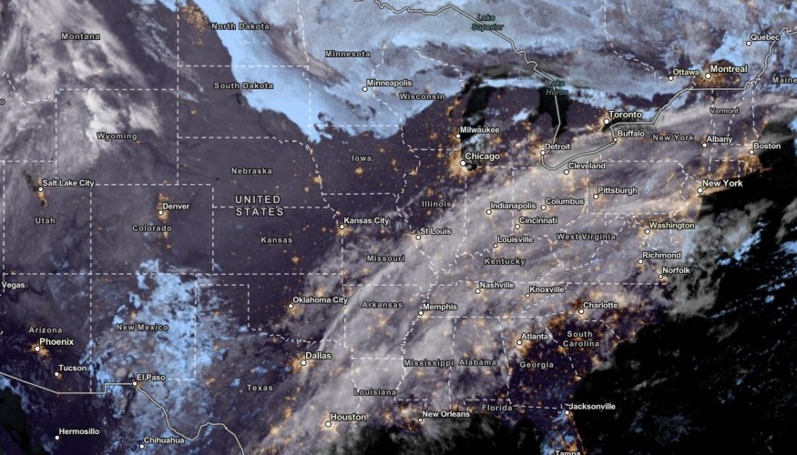
The late week in Southern Texas and Western Washington can expect heavy rain conditions, bringing potential small flooding and travel concerns.
People with travel plans are advised to monitor the forecasts before leaving their houses. In the Western US, a rainy outlook is forecasted for next week that could ease the critical fire risks in the region.
The rounds of rain will become beneficial in the Texas and Western US after they experience prolonged drought and dry conditions. In the Northeast and Midwest, the rain can be mixed with snow.
Heavy Rain in Western Washington and Southern Texas

The weekend will unload more rain in the South-Central US, including in Southern Texas and Western Washington. The National Weather Service (NWS) reported that locally heavy rain will hit eastern to Southern Texas this Friday morning.
The main dangers from the weather are localized flooding, heavy rains and flash flood risks in the affected areas. Motorists should watch out for slower commutes due to slipper travel and flooded roads.
NWS is monitoring a developing cold front from the Northeast to Texas. The cold front will also drive the cooler weather in the region, which temperatures can drop from 20 to degrees.
In addition, the colder air from the North will be ideal for people who want relief from heat. However, they should be prepared for locally heavy rains in eastern and Southern Texas.
On Saturday, the period of rain is expected in the following areas:
- Dallas
- Charlotte
- Memphis
- Nashville
- Atlanta
- New Orleans
- Houston
- San Antonio
- Brownsville
- San Antonio
- Lubbock
- Odessa
- Jackson
Areas in the South-Central US have experienced severe to extreme drought concerns. The arriving rain will help with the problem. It can also lower the risks of wildfires in the region.
On the weekend, the rain could reach from two to four inches.
Meanwhile, the Great Lakes region could unload snow and light rain in the late week. There is also a weak cold front and upper trough in the region.
The cold front will help with the rains in Washington, including in Northern Rockies and Northwestern US. Homeowners traveling to said areas should watch out for the threats of snow and rain. Snowfall can likely reach from one to two feet.
Weather Preparedness: Rain Can Cause Flooding
Homeowners should stay alert for small to severe flooding this late week. In addition, motorists should stay careful with foggy road conditions and flooded roads.
Flood-prone areas can be at risk of the weather, and homeowners should stay away from floodwaters.
Did you know? Wildfires can appear due to warmer temperatures, dry vegetation, low relative humidity and strong winds. When you see the said signs, you should stay alert.
Related Article : Rain, Thunderstorms Likely in Southern Plains, Lower Mississippi Valley; Cooler Weather Expected in Upper Midwest
For more similar stories, don't forget to follow Nature World News.
© 2025 NatureWorldNews.com All rights reserved. Do not reproduce without permission.


