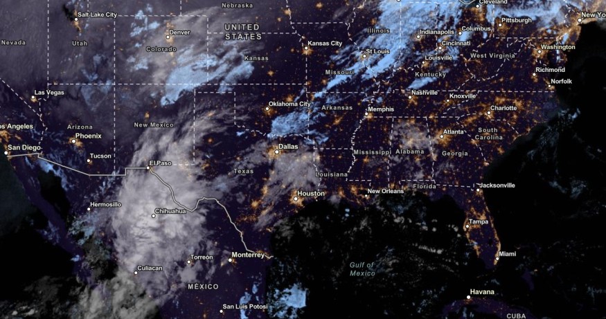
Challenging weather conditions are forecasted in Texas and Louisiana this week, bringing potential flash flood risk and localized flooding.
Motorists can anticipate travel delays due to the weather.
Some parts of the US will experience freezing and colder conditions, especially in the Northeast and Pacific Northwest. In the South-Central US, residents suffered from dry and prolonged drought conditions.
In addition, the relief from warm weather and drought is expected this week. Heavy precipitation is expected in the region, easing the dry conditions.
Rain is coming tomorrow and Friday. Most Middle Tennessee locations can expect between 1/2" to 1" for the two-day event. After that, it turns chilly again. The 6-10 day outlook suggest a return to drier-than-normal conditions after this next rain event. pic.twitter.com/1HYsCWDACo
— NWS Nashville (@NWSNashville) November 8, 2023
However, homeowners should still stay alert for weather hazards. The challenging weather conditions can result in heavy rains, flooding, landslides and travel disruptions.
US Weather Forecast: What Is the Weather in Texas and Louisiana?

The main concern about the weather is the rainy conditions starting in the late week. According to forecasts, the rain will ease the severe drought conditions in the region.
The rainy pattern is expected in Eastern Texas and Louisiana. The rain is forecast in the following areas:
- New Orleans
- Jackson
- Memphis
- Nashville
- Shreveport
- Houston
- San Antonio
- Dallas
- Brownsville
In addition, dense fog conditions are expected in New Orleans. Recently, multi-vehicle accidents occurred in the region due to the super fog, reducing road visibility. Motorists are reminded to check the road conditions before going out.
While the rain can ease the drought conditions, localized flooding is concerning in the region. About one to three inches of rain could unfold, especially in parts of Louisiana, Austin, Corpus Christi and Houston.
On Friday, the rainy conditions can be likely in the following:
- Lubbock
- Odessa
- Dallas
- Austin
- San Antonio
- Houston
- New Orleans
- Jackson
- Little Rock
NWS Nashville reported that the region could experience chilly conditions in the late week. Residents can also anticipate a windy outlook.
Next week, the forecast noted that rain could still emerge in New Orleans, Austin, San Antonio and Laredo. The dry conditions could unfold in Raleigh, Atlanta, Nashville, Little Rock, St. Louis and Wichita.
In Austin and San Antonio, a cold front is expected in the southern Edwards Plateau. Isolated showers or stormy conditions can be possible. With locally dense fog, a patchy fog outlook is also possible in the region.
Also Read : Dense Smoke,Fog Cause Multi-Vehicle Accident on Interstate 10 New Orleans; One Death Reported
Localized Flooding, Heavy Rains: How Can People Stay Safe
According to forecasts, the challenging weather could start on Thursday. Homeowners should anticipate localized flooding and heavy rains. Here are the essential reminders to keep safe from flooding rains.
People should stay updated with the weather, including troublesome fog. When the outlook becomes dangerous, staying at home is the recommended decision.
In addition, homeowners and motorists should keep away from flooded roads. People in low-lying and flood-prone areas should stay alert for the rise of water.
Did you know? Super fog can occur without notice. It can cause dangerous road conditions and accidents. Motorists should stay a distance from other vehicles.
Related Article : "Witch Storm" November: How Does It Affect Weather in Midwest?
For more similar stories, don't forget to follow Nature World News.
© 2025 NatureWorldNews.com All rights reserved. Do not reproduce without permission.


