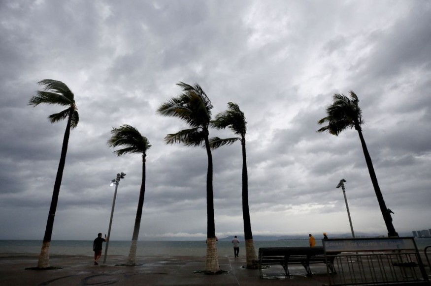
As areas across the US are under High Wind Warnings, the northwest will see windy and rainy conditions. Southwest is experiencing oppressive heat of 100 degrees Fahrenheit.
Contrasting Weather for Northwest and Southwest US
According to meteorologists tracking the weather across the western United States, the first half of this week will feature contrasting trends from the Northwest to the Southwest.
While inhabitants in the Southwest are caught under an area of high pressure that will bring high temperatures reaching into the 100s Fahrenheit, other areas will experience damp and windy weather as a storm spreads rain and showers around the Northwest coast.
Brief Storm and High Wind Warnings
A storm is heading toward the Pacific Northwest this week, bringing rounds of rain from Northern California to northern Idaho and northwestern Montana. By Tuesday morning, a cold front will hit the coast, leading to stormy conditions. Increased winds will affect Washington and Oregon, with gusts up to 45 mph over open waters on Sunday.
Coastal areas like Westport, Washington, will experience winds of 20-30 mph with gusts to 35 mph on Monday. Small craft advisories and gale warnings are in place for rough seas and gusty winds until Tuesday evening.
Winds will extend inland to the northern Rockies through Tuesday night, with speeds of 25-35 mph. Western and central Montana is under a High Wind Warning and wind advisory until Tuesday evening. Strong gusts on the Rocky Mountain Front may reach 60-70 mph, impacting travelers, especially high-pro
Tuesday's Temperature Drop
The storm will briefly lower temperatures in the Northwest until Tuesday. Portland will see mid-60s temperatures, close to mid-October averages. In Washington, cities like Seattle and Yakima will experience a slight temperature drop, just a few degrees lower than the weekend.
Some snow may fall in the highest northern Cascades and Rockies elevations, but significant snow level decreases aren't expected this week. Glacier National Park might see a few snowflakes by Tuesday, while other areas remain relatively unaffected.
Bolaven Leaves Showers in Its Tracks
Former Super Typhoon Bolaven is now heading for the Gulf of Alaska, with rain and wind impacting the Aleutian region, the peninsula, and Southeast locations until Wednesday. Meteorologists anticipate increased showers due to Bolaven's moisture in the Aleutians on Monday, with more significant impacts arriving late Monday night or early Tuesday in southeastern Alaska.
Wind and rain will intensify, with possible gusts up to 50 mph in the southeast and over 40 mph in the Aleutians. Conditions are expected to gradually improve later in the week. This system will also affect the western U.S. by pushing the jet stream northward, bringing drier and warmer weather to the Northwest states.
Also Read gy : Artificial Photosynthesis Scaled Up Can Replace Solar Panels in Producing Limitless Clean Ener
Southwest US Gets Toasty 100 Degrees and Up
While the Northwest faces stormy conditions this week, the South will enjoy rising temperatures and sunny skies. A high-pressure ridge over the Southwest will bring warmth. Downtown Los Angeles and Las Vegas will see highs near 90°F, about 10 degrees above mid-October norms. Southern California and southern Arizona may hit 100°F.
Phoenix recently reached 105°F, breaking the 2020 record for the date and marking the latest 105°F reading ever recorded. The warmth will move north into the Northwest later in the week, allowing temperatures to rebound after a brief cool period with a cold front next Monday and Tuesday.
© 2025 NatureWorldNews.com All rights reserved. Do not reproduce without permission.


