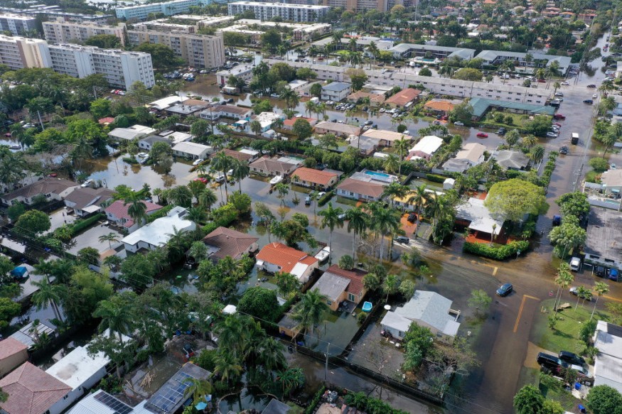
A tornado was confirmed to have touched down in Florida amid a severe weather threat across the state, according to reports on Thursday afternoon, April 27.
The National Weather Service (NWS) reportedly said the tornado was located 9 miles south of Greensboro town in Gadsden Country, Florida, at 4:09 p.m. ET (local time), moving at a speed of 20 miles per hour in a northeastern direction.
The NWS issued Florida tornado warnings in different parts of the Sunshine State. T
he tornado alerts serve as an sign that a particular area is at risk of being hit by destructive or deadly twisters with or without warning.
This comes as a severe thunderstorm struck Florida and its adjacent states across the region.
Severe Weather Threat

Severe storms are expected for most parts of the Gulf Coast starting Thursday, from south Texas and southern Louisiana to the Florida Panhandle, according to the latest severe weather report by the NWS.
During this period, localized to regional disruption to travel, businesses, and daily outdoor activities are expected.
In its short-range forecast on Thursday, the NWS' Weather Prediction Center (WPC) stated additional rounds of heavy rain and severe weather are possible to impact the southeastern quadrant of the U.S. until late week.
The inclement weather is caused by an "active and complicated weather pattern" that is affecting different areas of the eastern two-thirds of the U.S., expected to continue in the coming days.
Florida Tornado Confirmed
After the forecast, a large and "extremely dangerous" tornado was confirmed in Florida on Thursday, with the NWS describing the situation as life-threatening, ABC News reported.
Amid the tornado threat, the NWS office in Tallahassee issued a tornado warning for some areas of Gadsen County and Liberty County until 4:45 p.m. ET and Kinard area.
The confirmed Florida tornado occurred in the city of Lynn Haven, located near Panama City along the Gulf Coast, shortly after 3 p.m. CT (local time).
Severe thunderstorm watches are also given by NWS for most areas of northern-eastern Florida and southeastern Georgia, where it would take effect until 10 p.m. on Thursday.
Over 15 million people are under a severe weather threat in the affected areas.
Other Weather Forecast
While the Southeast U.S. is under severe weather alert, the NWS said another round of wet snow is likely to spread from the northern to the central parts of the Rockies from Thursday evening to early Friday, April 28.
Meanwhile, in the West Coast, the weather service said a warming trend could surpass temperatures records by Friday, while the rest of the country could experience below-average temperatures for large parts of the country from the Rockies and eastward.
In recent days, FOX Weather meteorologists forecast that the American West could experience significant warmup later this week and even until the weekend, leading to rapid snowmelt.
© 2025 NatureWorldNews.com All rights reserved. Do not reproduce without permission.


