According to a recent report, a new advanced satellite and measurements could help monitor the global warming effects on rivers and lakes, which could detect and prepare communities for the potential impact of water-related disasters.
Flooding has been a major concern of communities and countries. Flooding could be life-threatening and leave catastrophic damage.

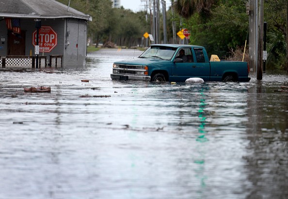
Recently, the impact of Hurricane Ian and Nicole left massive damage to communities in Florida.
The widespread flooding in Florida due to Hurricanes caused deaths and catastrophic aftermath.
Meanwhile, poorer countries also suffer from the same fate with insufficient budgets to purchase advanced equipment for flooding detection and disaster preparedness, putting many people's lives at risk.
Furthermore, climate change and global warming also contribute to supercharged storms and hurricanes.
Climate change and human-caused activities destroyed important forests that were the main defense against natural disasters.
On the other hand, melting ice in the Antarctic glaciers has raised concerns among environmentalists and scientists due to the potential global rise of ocean water.
As a result, the importance of advanced equipment to monitor the water and prevent water-related disasters is crucial.
According to a CNN recent report, a mission is deployed to measure and monitor Earth's water.
The mission is an initiative of the French space agency Centre National d'études Spatiales and NASA.
The mission has been known as SWOT (Surface Water and Ocean Topography), which began to lift off at the Vandenberg Space Force Base in California.
CNN report explained that the mission aims to observe the world's water, adding the importance of measuring the ocean and freshwater height.
The SWOT technology could help provide measurements about water bodies, helping countries and communities prepare for water-related disasters.
Furthermore, the satellite could also monitor how climate change and global warming affect bodies of water and reservoir.
Climate change and global warming are key drivers of oceans' warming. In addition, the SWOT satellite could survey the world's water and its effects on the environment.
The satellite could become an important collaborative effort. According to CNN, NASA Benjamin Hamlington explained that the satellite could help track the Earth's water movements across oceans, indicating which locations could have sufficient to insufficient water.
The report explained that the satellites could cover all rivers wider than 100 meters, helping researchers to look into volume changes in bodies of water such as lakes and rivers on the planet.
KaRIn radar instrument
While many researchers relied on other traditional instruments to monitor bodies of water, they could cover limited spots or face challenges in obtaining accurate data.
According to a CNN report, the said SWOT satellite could detect or monitor bodies of water ten times smaller than what sea-level satellites could show and even generate data at night, especially on freshwater.
In monitoring the melting of ice and climate change, the report explained that the SWOT satellites could be essential in observing the changes in water in Alaska and the potential effects of climate change there.
The inaccessibility of current satellites to observe water movement across the globe will change with the advanced features of SWOT.
It would help communities plan and develop disaster policies regarding water-related events.
Related Article : Toxic Algae Blooms Emerge in Portions Southwest Florida Coastline That Could Cause Fish Kills and Respiratory Risks
For more similar stories, don't forget to follow Nature World News.
© 2025 NatureWorldNews.com All rights reserved. Do not reproduce without permission.


