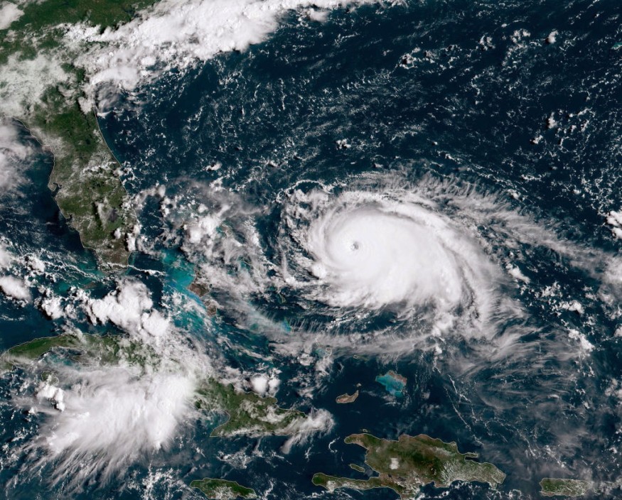
Hurricane Nicole is currently hovering towards Florida, United States, after making landfall in the Bahamas earlier on Wednesday, November 9, bringing powerful storm surge to the Sunshine State.
Former Tropical Storm Nicole intensified into a Category 1 hurricane on the same day and is set to make landfall in Eastern Florida in the coming hours or by approximately midnight on Thursday, November 10.
In the coming hours, the Category 1 hurricane is likely to continue bringing strong storm surge along the Florida coastline, causing coastal flooding or erosion.
In addition, the storm could also cause massive flooding due to heavy rain and strong winds, leading to widespread disruption and infrastructural damage.
New hurricane alerts and evacuation orders are also likely to be implemented by Florida officials.
In recent days, initial weather forecasts by US weather authorities and meteorologists hinted that Nicole will hit the East Coast by making landfall first in Florida and make its way up towards the Northeast US.
In addition, the looming hurricane threat could disrupt not only the election week but also create a déjà vu experience for Floridians of the destructive path left behind by Hurricane Ian more than a month ago.
The expected arrival of Nicole in Florida poses a significant threat since the state is still recovering from the devastation left behind by Ian when it made landfall in the southwestern part of Florida on September 28 and traversed its way upward the East Coast in the succeeding days.
Ian, a Category 4 hurricane, reportedly left at least 100 people dead and tens of thousands displaced in several states.
Hurricane Nicole

AccuWeather meteorologists acknowledge the dangers of damaging storm surge, high winds, and flooding from Hurricane Nicole in Florida, which is expected to experience hazardous weather conditions for several parts of the state within 48 hours.
The storm is also expected by the AccuWeather forecasters to make landfall in the Fort Pierce, Port St. Lucie, and Stuart areas of the state on the said time period.
The outer bands of Nicole has already started impacting eastern-central Florida, according to the National Weather Service (NWS) office in Melbourne, Florida, as cited by CNN.
In addition to heavy rain and storm surge, the approaching storm can also reportedly generate tornadoes or twisters across eastern Florida, southern South Carolina, and southeastern Georgia.
What is a Storm Surge?
In addition to torrential rain, which can cause flooding to inland areas by drenching low-lying areas or communities near bodies of water, there are other weather events capable of bringing floodwaters to the coastline of an island or mainland: storm surge.
Storm surge is the rise in seawater level caused mainly by a storm, especially if the wind gust or maximum sustained winds are equivalent to hurricane-force winds.
Alternatively, it is the abnormal rise of the height of water above the normal measurement as powerful winds from a storm push the seawater into the shote, according to the National Oceanic and Atmospheric Administration (NOAA).
The NOAA emphasized that powerful winds are not the only deadly force of nature during a hurricane; in fact, the greatest threat to life actually comes from the sea or ocean.
© 2025 NatureWorldNews.com All rights reserved. Do not reproduce without permission.


