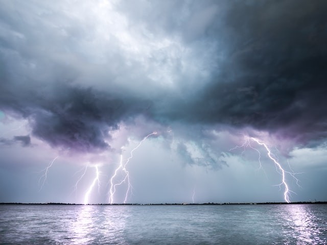
The central U.S. will experience more severe storms. This past weekend, severe storms hit the Midwest, causing floods, wind damage, and even tornadoes. According to forecasters, Monday may be even busier.

Extreme Weather Forecast
Much of the north-central United States had to enjoy calm weather before this weekend, escaping the torrential downpours that swept over the Gulf Coast states and the Southwest, including record-breaking rainfall in Dallas. But according to AccuWeather's predictions, the Plains and Midwest will see unstable weather on Monday even after these two busy days.
Many areas are experiencing an abundance of heat and moisture, typical during the summer. A disturbance tracking across the country will take advantage of this warmth and humidity to produce storms.
According to AccuWeather Meteorologist Adam Sadvary, "warm and humid air in place, an oncoming storm system will contribute to a dip in the jet stream, helping to provide the last push necessary for these thunderstorms to form swiftly."
Strong Winds
Over a dozen complaints of damaging winds and hail in Iowa and Minnesota were made on Saturday as the first storms in the Midwest began to form. As destructive thunderstorms passed through, the Minneapolis region was particularly heavily affected. There were reports of flooding at the Minnesota State Fair.
The Midwest had more of the same on Sunday. Northern Illinois and Wisconsin saw the onset of the storms, with another zone of development in Minnesota moving into western Wisconsin. Separately, throughout Oklahoma, a large region of severe storms also formed. The Storm Prediction Center received over twenty reports of hail and powerful winds. Additionally verified was the touchdown of at least one tornado close to Prinsburg, Minnesota.
More To Come
To start the work week, more storms are expected to rumble over the central United States, with the risk for severe weather spreading to include regions from Michigan to the Texas Panhandle. Given the precise atmospheric configuration, Monday may be busier than the preceding two days.
According to AccuWeather Meteorologist Thomas Geiger, "the region of most concern will span from eastern Iowa to southwest Michigan and northern Indiana. Here, a fast moving and strong line of storms may go through, and destructive winds may not be hard to come by."
Thunderstorms may be less common generally as you move further south and west toward the Plains, and some areas could even see complete dryness. However, every storm that forms will potentially become severe if the atmospheric conditions are right.
The worst storms in Chicago might occur during the already congested evening commute. As families enjoy the final few summer weekends, storms may negatively impact travel. Air travel may affect areas like Detroit, Chicago, St. Louis, and Oklahoma City because thunderstorms can cause delays and cancellations.
Weather-related delays may also be experienced by travelers who choose to travel by vehicle, particularly along sections of Interstates 25, 55, 70, 80, and 90. It is advised that drivers take additional precautions when driving in bad weather and never cross flooded roads.
Waiting for Favorable Weather
Furthermore, calm circumstances might suddenly turn perilous since storms are expected to move swiftly. In case storms develop, persons in the region of extreme threat, especially those who spend a lot of time outside, should keep an eye on the most recent watches and warnings.
People expecting dry weather to return won't have to wait long, as thunderstorms are predicted to move out of much of the area by Tuesday as they focus on the Northeast instead.
Related Article : Exposure to Major Disasters Can Cause Long-Term Mental Health Problems
For more climate and weather updates, don't forget to follow Nature World News
© 2025 NatureWorldNews.com All rights reserved. Do not reproduce without permission.


