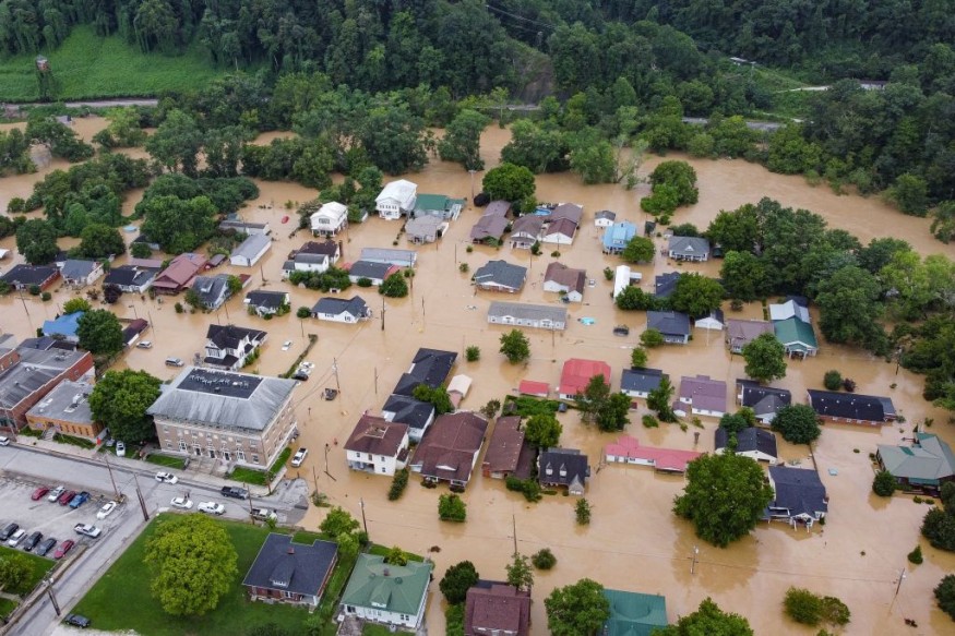
Heavy rain has continued to persist over the southern United States as of Monday evening, August 22, causing widespread flooding in multiple cities and towns.
US weather authorities have issued renewed weather alerts regarding the potential spread of the inclement weather to the Lower Mississippi Valley in the next several days this week.
The latest developments serve as an update from previous weather forecasts that the adverse weather will move from the South US toward the Mississippi Valley.
This comes after forecasts predicted that the persistent heavy rain will continue from northern Texas to southern Oklahoma by mid-week, bringing extensive flooding, runoff, and travel delays.
Prior to the current weather event, torrential rain inundated the Southwest US, causing major flooding in Las Vegas, Nevada, and its surrounding areas.
In addition, similar events also caused mountain flooding in Eastern Kentucky, resulting in the deaths of at least 37 people and hundreds of missing.
NWS Twitter Weather Update

The National Weather Service (NWS) on Twitter posted that the "heavy rain and widespread flooding event" throughout the Southern Plains on Monday, August 22, will move toward the Lower Mississippi Valley on Tuesday, August 23.
The tweet indicates there is a moderate risk of excessive rainfall with potential flooding from northern Louisiana into the west-central part of Mississippi.
Furthermore, the NWS divided the following weather hazards by severity pertaining to the probability of excessive rainfall that could lead to flash flooding:
- High Risk (purple) with at least 70% probability of rainfall
- Moderate Risk (orange) with at least 40% probability of rainfall
- Slight Risk (yellow) with at least 15% probability of rainfall
- Marginal Risk with at least 5% probability of rainfall
The event is part of the NWS' designation of the phenomenon as a multi-day flash flood threat or multi-day heavy rainfall event.
South US Heavy Rain Event
The NWS twitter update is almost similar to the weather outlook on its website on Monday.
According to the Weather Prediction Center (WPC) of the NWS, heavy rain and flash flooding threats are anticipated across areas of east Texas into the Lower Mississippi Valley over the next two days, possibly until Wednesday, August 24.
The WPC outlook is valid from Tuesday until Thursday, August 25.
However, this short-range forecast can be updated or revised with or without warning.
There were no immediate reports of fatalities or injuries from the current severe weather. However, there are already reports of large-scale disruption in some areas in South US.
In Texas, cars were submerged in Dallas as 7.8 inches of rain fell just within three hours, resulting in a total of 10 inches of rain on the east side of the city, NBC News reported.
Furthermore, the US weather agency says the "very wet weather pattern" will continue since a surface frontal boundary is forecasted to remain stalled across the said region.
The weather system is causing above-average levels of moisture, which can also cause active showers and thunderstorms, as well as its associated hazards of large hail and strong winds.
© 2025 NatureWorldNews.com All rights reserved. Do not reproduce without permission.


