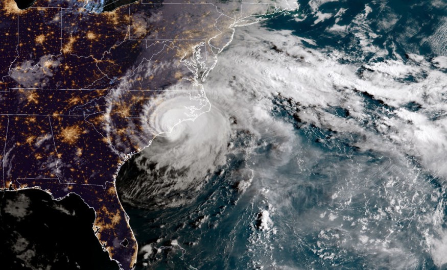
During the early days of the Atlantic hurricane season, meteorologists expect Agatha, the East Pacific's first named storm of the year, to redevelop over the southern Gulf of Mexico.

Agatha Incoming
Hurricane Agatha is expected to move onshore over Mexico on Monday evening, bringing devastating rain and severe winds. It might appear over the Gulf of Mexico or the Caribbean Sea around June 1, the start of the Atlantic season, where it could grow further.
"There is a low possibility of tropical development sometime between June 2 and 5 from the southwestern Gulf of Mexico to the northwestern Caribbean," Senior Meteorologist Dan Pydynowski said. "It's feasible that crossover energy from Agatha in the eastern Pacific will promote growth in any of these two Atlantic basin zones."
Even if Agatha moves more slowly than projected into and over Mexico, there is enough shower and thunderstorm activity on the Atlantic side to allow a tropical system to form.
"A large amount of wind shear is presently noticeable from southeastern Mexico to the southern Gulf and the western Caribbean," said Senior Meteorologist Mike LeSeney. When wind shear is significant or powerful, it can inhibit the development of a tropical system. That phenomenon would have to fade first, which is why development might not happen until later next week, if at all.
But, if something does form during the Atlantic hurricane season's early days, how will it go?
Aggressive Season
"Tropical development is far from a certainty," Lead Long-Range Meteorologist Paul Pastelok stressed, "but any tropical disturbance or organized system - should it form - would tend to be steered northeastward around an area of high pressure over the southwestern Atlantic." For example, if a tropical disturbance forms near Mexico's Yucatan Peninsula, it will most likely travel to Cuba, Florida, and the Bahamas.
Water temperatures are typically above average throughout this section of the Atlantic basin, mainly in the 80s F, much over the minimum threshold for tropical development, which is around 78 degrees. Water temperatures in the central and eastern Gulf of Mexico are well into the 80s, according to Pastelok. The loop current is a deep, warm-water circulation that transports warm Caribbean water up from the Yucatan into the Gulf of Mexico. As a result, any system that can move into or develop over these warm waters will receive a significant boost.
Trajectory
In June, the primary tropical development regions are the Atlantic basin waters over the western Caribbean, the Gulf of Mexico, and the southern Atlantic coast of the United States.
As it traveled inland over the central Gulf Coast, a disturbance that passed over the warm seas of the central Gulf of Mexico failed to form into a tropical storm or depression. On Monday, the system brought heavy rains and violent thunderstorms to the Southeast, demonstrating how even a loosely formed tropical disturbance may substantially influence the weather.
AccuWeather experts are also keeping an eye on a different part of the basin, off the southeast coast of the United States, where a mix of conditions might lead to the tropical formation in early June.
In the aftermath of a departing storm that delivered days of showers and thunderstorms from the central United States to the Southeast and mid-Atlantic, another storm is likely to form not far off the Southeast coast during the next few days.
That storm is expected to remain stationary off the southeast coast of the United States for a few days. Still, according to Pydynowski, it might change its nature and take on tropical or subtropical features. "This feature will need to be observed until late next week and beyond, although the chances of tropical development look quite slim."
Historical Record
For the first time since 2014, tropical development before the official start of the Atlantic hurricane season is not predicted this year, with the end of May quickly approaching. However, because of the lingering impacts of La Nia, meteorologists led by Hurricane Expert Dan Kottlowski still forecast an above-average hurricane season in 2022. For the United States, four to six direct impacts are projected.
Related Article : Exposure to Major Disasters Can Cause Long-Term Mental Health Problems
For more climate and weather updates, don't forget to follow Nature World News
© 2025 NatureWorldNews.com All rights reserved. Do not reproduce without permission.


