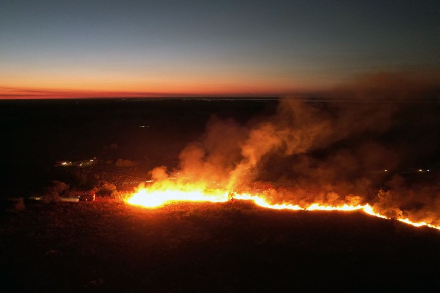
Fire weather warnings have been issued over the weekend for the Southwest US and the southern High Plains.
These advisories entail the risk of either the formation of new wildfires or the continuance of existing ones this week.
Abnormal heat and dry conditions are the main fuel of these fire weather conditions.
Fire Weather Warnings

The Storm Prediction Center (SPC) of the National Oceanic and Atmospheric Administration (NOAA) - National Weather Service (NWS) on Sunday, May 8, issued its latest fire weather warnings for the regions of concern.
Under the warnings, the level of fires will be divided into two: extremely critical and critical.
First, extremely critical fire weather conditions have been issued for central and eastern New Mexico, southeast Colorado, western Oklahoma, and Texas panhandles.
In New Mexico, the country's largest active wildfire, "Calf Canyon Fire," has continued to wreak havoc across the state, prompting the continued evacuations of approximately 12,000 households, according to Reuters.
The wildfire first broke out on April 6.
With the current fire weather conditions in place, the New Mexico wildfire is likely to further grow.
Second, critical fire weather conditions have been issued for most of the southern High Plains, where significant wildfire-spread concerns are expected across the region.
This is caused by the intensifying surface cyclone and dry surface conditions.
The fire weather warnings were initially in effect until Monday midnight, May 9, but have been extended throughout the day wherein the "major weather story" will be the fire weather concerns in the Four Corners regions, notably the extreme threats in New Mexico.
On the other hand, the NOAA - NWS also issued separate weather warnings for inclement weather in the Western US and potential strong to severe thunderstorms from Iowa into Minnesota and Wisconsin.
Fire Weather Forecasts
Fire weather conditions pertain to climatic factors such as relative humidity, dry fuels, soil moisture, warm or hot temperatures, and wind directions that favor the formation and spread of wildfires.
Similar to a weather forecast, meteorologists also base their forecast on these variables to predict future fires.
According to the National Wildfire Coordinating Group (NWCG), the following are the three types of fire weather forecasts used across the United States:
1. Fire Weather Planning (Zone) Forecast
2. Spot Weather Forecast
3. Incident Weather Forecast
The first type of forecast, the Fire Weather Planning (Zone) Forecast, is primarily issued for planning and situational awareness and is used by local fire authorities and local agencies for decision-making that is either related to preventing or suppressing fires.
For Spot Weather Forecast aims to support prescribed wildfire operations, natural resource management, rescue operations, and other measures to promote public safety.
This type of forecast can be issued from the local government or to the federal government, overseen by the NWS Weather Forecast Office (WFO).
Lastly, the Incident Weather Forecast is the most basic and common type of fire weather forecast, being issued almost daily by concerned US government agencies, particularly the SPC.
Unlike the first and second types, forecasts for fire weather conditions are more general and can range from short, to long-range outlook.
However, these forecasts can still be used by fire officials on the ground and local governments.
© 2025 NatureWorldNews.com All rights reserved. Do not reproduce without permission.


