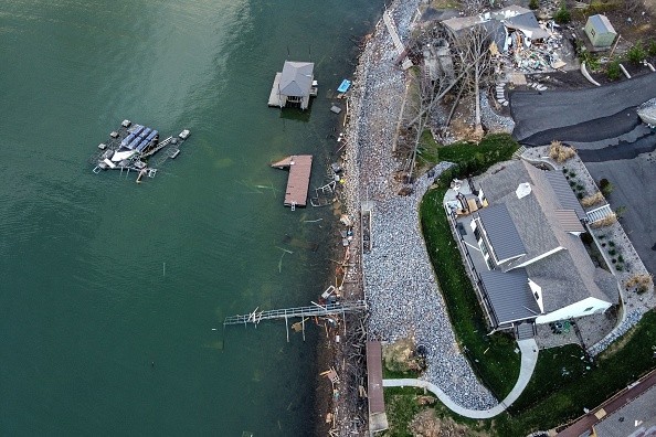
By early next week, millions of Americans will be at danger of severe thunderstorms capable of producing tornadoes, big hail, and devastating winds.
The southern Plains, Southeast, and Gulf Coast states will be the most vulnerable, with two waves of severe storms expected in the following days.
The first round of severe weather hit the Southeast on Friday and is anticipated to make its way to the Mid-Atlantic on Saturday.
Severe storms will strike the Gulf Coast this Friday

Extreme storms, including tornadoes, may threaten areas of the South on Friday as the atmosphere stays unpredictable, according to AccuWeather experts.
According to the Escambia County Sheriff's Office, many injuries were reported near Atmore, Alabama, as a possible tornado tracked through the region.
The community is located north of the westernmost point of Florida's Panhandle. During the extreme storms, nine mobile homes were destroyed.
For much of last week, damaging thunderstorms made their presence felt throughout sections of the south-central and southern United States, and additional storms will shock regions from the Ohio Valley to the Gulf Coast and mid-Atlantic through into weekends.
Thunderstorms mostly generated hail and a few cases of catastrophic wind over Oklahoma on Thursday, while a slow-moving storm system triggered devastating floods around Birmingham, Alabama, on Wednesday.
A massive storm rushed ashore on Fort Myers Beach, Florida, on March 12, sending tourists fleeing.
Later Friday, the National Weather Service Tallahassee issued tornado and thunderstorm warnings for sections of southwest Georgia and Florida's coast as storms moved over the Deep South in an easterly direction.
The Storm Prediction Center warned the risk of a violent, perhaps long-track tornado, as per NBC News.
Forecasters were especially concerned about hail the diameter of a baseball or bigger on the northern edge of Friday's risk region.
Weekends will most likely experience severe storms in other states
Paducah, Kentucky, Nashville, Tennessee, Birmingham and Montgomery, Alabama, Atlanta, New Orleans, and Tallahassee, Florida are among the cities to watch on Friday.
Tornadoes may weaken somewhat overnight before revamping Saturday morning, according to forecasts.
As the storm system advances eastward tomorrow morning, 12 million people in two locations are at danger of severe thunderstorms.
The Storm Prediction Center of the National Weather Service has issued an "increased" risk for severe thunderstorms on Friday in an area that encompasses sections of Alabama, far-northwestern Florida, and even some parts of western Georgia.
According to the SPC, more than 23 million people are at danger of severe weather on Friday, from the Gulf Coast to the Ohio Valley, with more than 2 million living in the region emphasized by the increased risk.
On Saturday, those two areas will experience a calmer day as thunderstorms move to the East Coast. The danger of severe weather there, though, may be slightly reduced.
Meteorologists emphasized Friday that, while more specifics about the components for next week's strong storms are still needed, all dangers, including tornadoes, extremely big hail, and destructive winds, are possible at this time.
With such a violent pattern on the horizon, meteorologists are giving these locations an early warning for next week. They urged everyone in the path of the storm to utilize the weekends to prepare and refresh their severe weather preparations.
© 2025 NatureWorldNews.com All rights reserved. Do not reproduce without permission.

