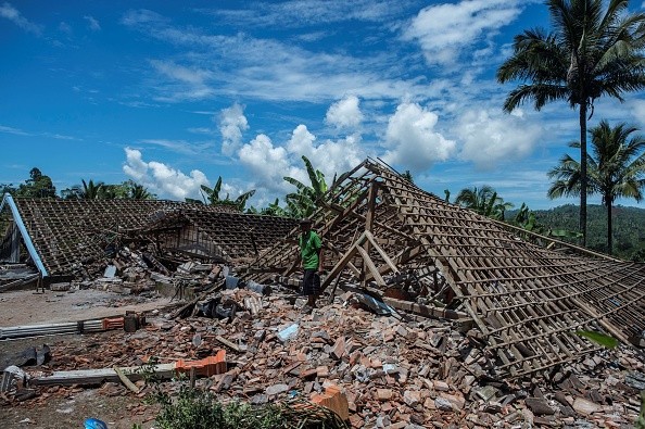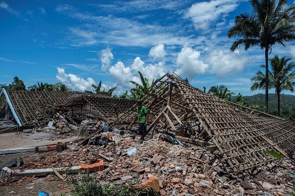
A series of strong, shallow underwater earthquakes rattled western Indonesia and the Philippine capital region on Monday, but no significant damage was recorded and no tsunami warnings were issued.

Earthquakes in Indonesia, Philippine
The U.S. Geological Survey reported that a magnitude-6.7 earthquake with a depth of 16 kilometers (10 miles) struck West Sumatra Province, 169 kilometers (104.8 miles) west of Pariaman, as per Phys.org.
According to Indonesia's Meteorology and Geophysics Agency, numerous portions of the province were affected, although there was no tsunami threat. The quake hit about 161 kilometers (100 miles) southeast of South Nias, the district of North Sumatra province.
No damage or casualties were recorded following an earthquake of magnitude 6.4, according to the Philippine Institute of Volcanology, Seismology and Meteorology.
Philippines' Institute of Volcanology and Seismology stated the quake's epicenter was located around 110 kilometers (68 miles) west of Lubang island, which is located in Occidental Mindoro province, which is south of Manila. About 28 kilometers below the surface, it had a depth of approximately 17 miles.
On the Pacific Ring of Fire, Indonesia and the Philippines are in the path of most earthquakes and volcanic eruptions in the world.
At least 16 people were killed and more than 400 were injured after a 6.2 earthquake struck Indonesia's West Sumatra province last month. Tremors detected as far afield as Malaysia and Singapore damaged thousands of homes and other structures.
Worst-hit Regions
Those living in wooden houses in the Nias and Hibala islands of North Sumatra, which are sparsely populated, felt it the most intensely. People ran outside with their families when the earthquake hit the coastal area, says Zagoto, an Indonesian who goes by one name.
It was so violent that the earthquake woke Zagoto from a deep slumber, he told AFP. Several powerful aftershocks followed the original tremor, according to the Indonesian Meteorological and Geophysics Agency..
Residents in Manila were awakened by the shaking of their buildings at 5:05 a.m. (2105 GMT) when the offshore quake struck the Philippines, according to Abc News.
Despite this, the Philippine Institute of Volcanology and Seismology predicted that little harm will be caused.
Past Earthquakes in Indonesia
An earthquake of 9.1 magnitude struck Sumatra's shore in 2004 and spawned a tsunami that claimed the lives of 220,000 people in the region, including 170,000 in Indonesia. On the Indian Ocean's outer border, the tsunami and its aftershocks caused unimaginable devastation and death.
Officials in Indonesia estimate that the death toll in Aceh, a province in northern Sumatra, may have reached as high as 200,000.
In Sri Lanka and India, tens of thousands of people were reported dead or missing, many of them from the Indian region of the Andaman and Nicobar Islands. More than a hundred people were killed and the economy of the Maldives was devastated by the typhoon.
Thousands of non-Asian visitors visiting the area were reported missing or killed as well. More people died as aid workers struggled to bring supplies to places cut off by destruction of roads or ravaged by civil war due to a lack of food, clean water, and medical care.
Villages, tourist destinations, farms, and fishing grounds were all destroyed or submerged by debris, bodies, and plant-killing salt water, resulting in long-term environmental devastation.
For more news, updates about earthquakes and similar topics don't forget to follow Nature World News!
© 2025 NatureWorldNews.com All rights reserved. Do not reproduce without permission.


