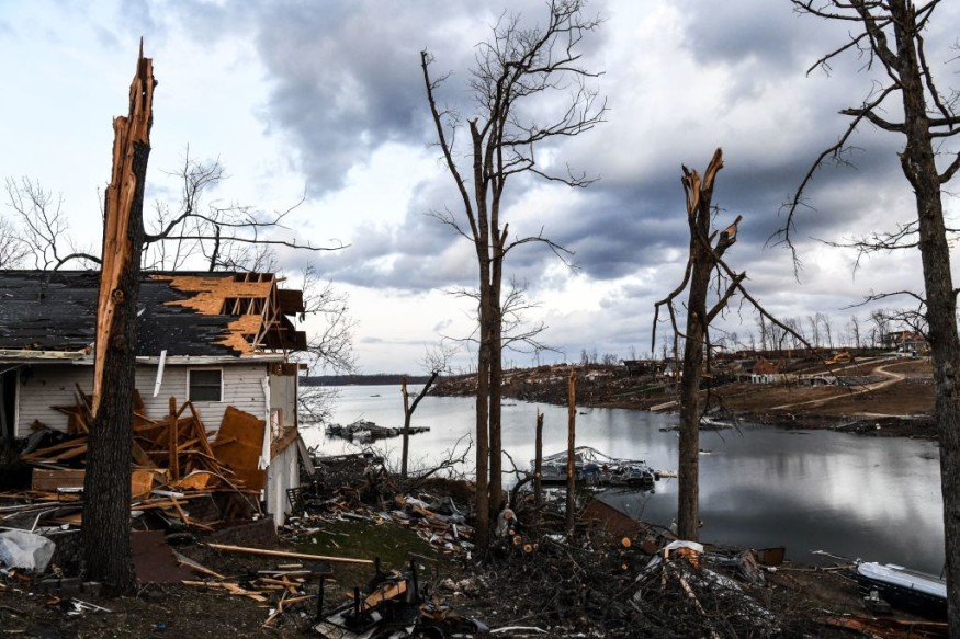
Late Friday and Friday night, the second round of severe weather is expected to explode from the northern Gulf Coast to the southern Atlantic Seaboard, encompassing regions impacted by a round of thunderstorms and potential tornadoes on Wednesday.

According to AccuWeather meteorologists, the next round of severe weather will bring the threat of tornadoes.
Tornadoes Running Around
Early Wednesday morning, a couple of tornadoes were recorded throughout the upper Gulf Coast from southern Mississippi to southwestern Georgia and the western section of the Florida Peninsula.
According to the National Weather Service Storm Prediction Center (SPC), the extreme weather damaged some residences, but no casualties were recorded. During the day on Wednesday in Florida, there were a few reports of high winds.
Extreme Weather
The threat of severe weather and tornadoes in the Southern states will resurface at the end of the week.
It won't be long before thunderstorms erupt and turn severe throughout parts of the Southeast when a new storm system forms in the upper Gulf Coast on Friday and swiftly strengthens.
Thunderstorms producing violent winds, flash flooding, and tornadoes will be spawned by a surge of warm and humid air mixed with strong winds in the middle and upper atmosphere.
According to Meteorologist Nicole LoBiondo, the first severe storms will hit the Florida Panhandle, southern Alabama, and southwestern Georgia late Friday. During Friday evening, the danger of severe storms will move to northern and eastern Georgia, the upstate and midlands of South Carolina, and the north half of the Florida Peninsula.
The severe weather danger is expected to spread from northeastern Florida through central North Carolina and coastal regions of North and South Carolina late Friday night into Saturday morning.
To end out the week, major cities such as Atlanta, Charlotte, North Carolina, Mobile, Alabama, Charleston, South Carolina, and Jacksonville, Florida will be vulnerable to severe weather.
Trajectory
The threat of severe thunderstorms with significant wind gusts may continue northward across southern Virginia and the Delmarva Peninsula. The storm system intensifies swiftly while moving northeastward through the Appalachians late Friday night into Saturday. Wind gusts with and without thunder and lightning are also possible in southeastern New England on Saturday afternoon and evening.
On Saturday, a line of heavy to severe thunderstorms is expected to move southeastward through the Florida Peninsula. People in Orlando, Tampa, and the region's amusement parks should be on the lookout for shifting weather conditions.
Storms capable of bringing severe gusts and flash flooding may spread to Fort Myers and Key West, Florida, on Saturday afternoon, making it a bad day to go boating in the seas off the peninsula and islands.
However, the same weather pattern that has brought catastrophic weather and isolated flash floods to the Southeast will also bring advantages.
Although the storms' hazards should not be disregarded, AccuWeather Meteorologist Jessica Storm stated that rainfall could give much-needed respite for wildfires raging across the region.
Temperature
Due to the abundance of dormant, dead, and dry plants. Rising temperatures and windy weather without rain have increased the wildfire risk in recent weeks, with many devastating fires already burning this season. According to a news statement from the Florida Department of Agriculture and Consumer Services, roughly 130 wildfires were burning more than 32,000 acres in Florida as of Tuesday evening.
The Chipola Complex Fire, which had burnt more than 29,000 acres by Tuesday evening over at least three counties, including Gulf, Calhoun, and Bay, was one of the state's most active wildfires. According to the press release, the spreading fire caused further evacuations in Calhoun County on Tuesday.
The soaking rain that began this weekend will assist in wetting the soil and may help limit the number and severity of wildfires.
Dry Areas
According to the USGS, portions of the Gulf Coast and the southern Atlantic coast are abnormally dry, while other sections, such as the western Gulf Coast, are experiencing severe and exceptional drought. Drought Monitor is a website dedicated to tracking drought conditions. The second-highest degree of drought is extreme drought, while the third is severe.
For example, in Gainesville, Florida, rainfall is generally low throughout the winter, but since December 1, the city has received around 62% of its average rainfall. Through March 9, only 6.16 inches of rain had fallen, compared to the typical 9.87 inches. Since February 1, the rainfall percentage has been consistent, at 65 percent, with just 2.40 inches falling.
The heaviest rain from the late-week storm would likely miss the Gulf coast's more extensive drought zones.
On Saturday, the possibility of severe weather in the Southeast states and soaking downpours will pass from west to east, with dry weather to follow. However, strong northwesterly winds in the aftermath of a cold front might make firefighting activities difficult for a period on Saturday.
For more climate and weather updates, don't forget to follow Nature World News!
© 2025 NatureWorldNews.com All rights reserved. Do not reproduce without permission.


