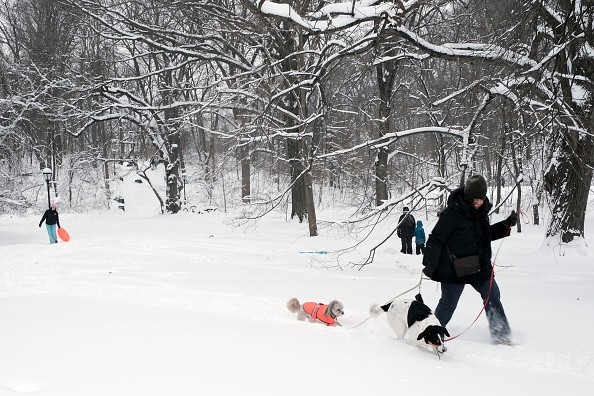
A powerful winter storm is expected to dump heavy snow throughout the northern tier of the Northeast on Friday, as well as a wintry mix and rain across areas of the mid-Atlantic.

AccuWeather meteorologists warn that another wave of Arctic air will sink southward later this weekend, triggering a new outbreak of severe snow squalls for parts of the Northeast.
Temperature Fluctuations
Since last week, temperatures in the Northeast have been fluctuating from day to day, and this pattern is expected to continue until February draws to a close. For example, in New York City, high temperatures have fluctuated from 59 degrees Fahrenheit on February 12 to 25 degrees Fahrenheit on February 14, 68 degrees Fahrenheit on February 17, 36 degrees Fahrenheit on February 20 and 68 degrees Fahrenheit on February 23.
When a simple cold front approaches, as is expected to happen on Sunday, temperature fluctuation might increase the severity of precipitation.
A dry and chilly air pocket will fall over the area on Saturday. The comparatively calm weather could improve travel conditions after the multi-faceted winter storm, assisting personnel in cleaning roads of heavy snowfall across upstate New York and New England.
Temperatures will be 5-15 degrees below average due to the chilly air. Highs will vary from the teens and twenties in the northern tier, where snow is still on the ground, to the lower to middle 40s in the Chesapeake Bay region.
Temperatures are expected to return to near-seasonable levels on Sunday afternoon, just ahead of a reinforcing rush of cold air. Highs will be in the 30s over much of New England and the 50s in the lower section of the mid-Atlantic due to the minor temperature rise.
Related Article : Snow Quall Warning Keeps Everyone on the Edge
Intense Weather
That warmth might potentially provide enough energy for flurries and snow showers linked with an Arctic cold front moving south from Sunday afternoon to Sunday evening. That boost might make the showers a little stronger than they would be if the air remained cold, similar to how a warm spring day boosts thunderstorms.
Like their warm-season counterpart, these larger snow showers, known as snow squalls, may hit regions hard and quickly. Intense snow squalls moved from the Midwest to a significant section of the Northeast on Feb. 18-19, causing a fast loss of sight and a small deposit of ice on some local highways.
Temperatures will be 15-25 degrees lower on Monday due to the cold front than Sunday's highs. Monday's high temperatures are expected to be in the lower teens in northern New England and the lower 40s in the Chesapeake Bay region. On Tuesday, there's a chance of another snow squall.
Drivers traveling on high-speed roads, particularly those connecting northern and western Pennsylvania to upstate New York and New England, should be aware of quickly changing weather conditions, which can reduce visibility to a few hundred feet or less in seconds. Interstate roads 79, 80, 81, 86, 87, 88, 89, 90, 91, and part of 95 are the most vulnerable to these circumstances from Sunday afternoon through Sunday evening.
Previous Snow Squall
Compared to last Saturday, the general coverage and severity of the snow squalls on this Sunday may be less intense. On the other hand, squalls can be dangerous on a local level and over small segments of the highway. All it takes is one unexpected squall to cause a hazardous multiple-vehicle collision in a busy traffic environment.
Even if squalls fail to reach the I-95 mid-Atlantic corridor, which includes major metro areas such as New York City, Philadelphia, Baltimore, and Washington, D.C., or weaken before reaching this area, motorists trying to get back to those cities Sunday evening may face delays if they travel through the interior of the mid-Atlantic and New England.
By Sunday evening, snow showers and stronger snow squalls in New England and the mid-Atlantic area can stretch further to the southeast.
Forecasts
Forecasters warn that individuals wanting to travel should keep a careful eye on the weather since snow squall warnings might be issued. The best protection is to avoid driving on interstate roads or to pull over and wait until the squall has passed during a snow squall.
This weekend, the safest period to drive on area roadways in the Northeast, especially in areas at danger of snow squalls, is expected to be Saturday afternoon through Sunday early. However, icy areas may persist from Saturday evening until early Sunday, when any residual damp spots freeze after Friday's storm.
For most recent weather news, don't forget to follow Nature World News!
© 2025 NatureWorldNews.com All rights reserved. Do not reproduce without permission.


