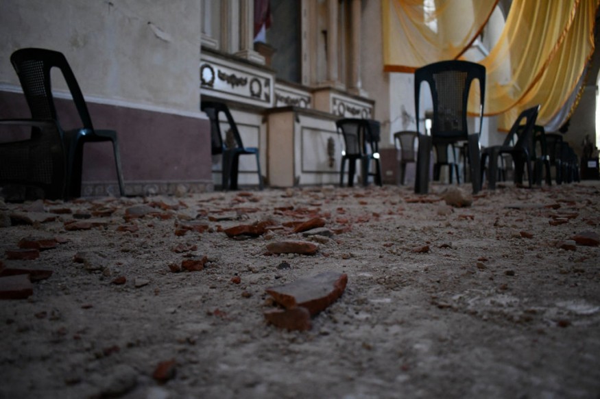
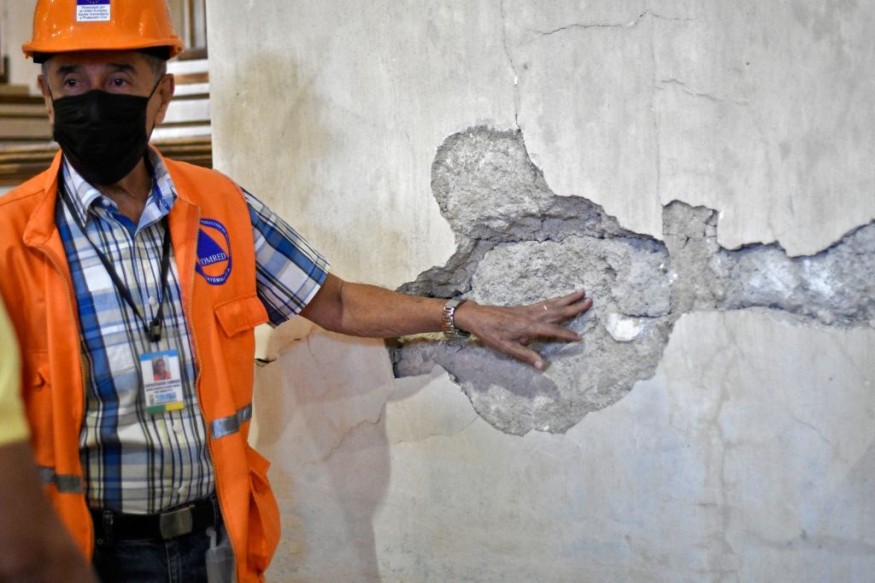
Authorities say a 6.2-magnitude earthquake that slammed western Guatemala early Wednesday caused damage to over 25,000 people and resulted in three fatal heart attacks.
Reuters reported that the earthquake's epicenter was near the coastal province of Escuintla, less than 100 kilometers southwest of Guatemala City, at a depth of 84 kilometers (52 miles).

According to EMSC, the quake's epicenter is 16 kilometers east of Tiquisate, Guatemala. Tiquisate is bordered by enormous banana and palm oil plantations that export to the United States and is located in a predominantly impoverished district on the Central American nation's coastline plain.
The United States Geological Survey reported a magnitude of 6.2. However, Guatemalan officials believed it to be greater, at 6.8, with a magnitude of 4.8 aftershocks.
According to emergency services, the quake triggered landslides on highways, housing damage, and power outages, xxximpacting 31,300 people.
Officials attributed three women's deaths to the earthquake without clarifying how they were linked.
In the town of Mixco, west of the city, a 50-year-old lady died. The other two ladies were found in the northern department of Baja Verapaz and the western city of Quetzaltenango; officials did not specify their ages.
El Salvador, Guatemala's southeast, and southern Mexico were also affected by the tremor.
A landslide was also recorded by firefighters on the route connecting the capital to Antigua, Guatemala's biggest tourist destination.
Rockfalls and toppled trees were seen obstructing roadways following the earthquake, including Antigua, a historic city popular with visitors, according to images published on social media by the agency.
Related Article : USGS Discovers Growing Bulge Near Three Sisters Volcano Due to Increased Seismic Activity
Earthquake Activities in Guatemala

The earthquake-prone Central American country is situated at three tectonic plates. More than 125 earthquakes struck Guatemala last year, with no fatalities or substantial damage.
The earthquake had a magnitude of 6.8, according to Guatemala's disaster organization, the National Coordinator for Disaster Reduction (CONRED).
Guatemala experiences earthquakes on a somewhat regular basis. The Motagua and Chixoy-Polochic fault complex, which cuts across Guatemala and constitutes the tectonic border between the Caribbean and North American Plate, runs through the nation.
Seismic Activities
The Cocos plate pushes against the Caribbean Plate along Guatemala's western coast, generating the Middle America Trench, a subduction zone about 50 kilometers off Guatemala's Pacific coast.
The Central America Volcanic Arc was formed due to this subduction zone, and it is a major source of offshore earthquakes. These main tectonic events caused deformations in the Caribbean plate, resulting in subsidiary fault zones such as the Mixco, Jalpatagua, and Santa Catarina Pinula faults.
A handful of low-magnitude earthquakes produced significant damage in highly confined locations, which may be explained in part by their shallow depth. This was the situation with the 5.0 Mw Uspantán earthquake of 1985, which destroyed most of the structures in Uspantán but caused little or no damage elsewhere in the nation.
Read also: Long Valley Supervolcano: World's Most Dangerous Volcano Shows Signs of 'Imminent Eruption'
For similar news, don't forget to follow Nature World News!
© 2025 NatureWorldNews.com All rights reserved. Do not reproduce without permission.


