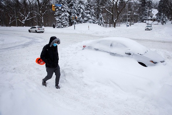
Arctic air is expected to move into the Mid Atlantic and lower Ohio Valley, bringing light snow to some regions Thursday. On Tuesday, a ridge of high pressure will form over the western and southwestern U.S., moving out to sea Wednesday.

Areas to Experience Light Snow
An Arctic cold front moving in from the northwest will have the opportunity to surge across the Mid-Atlantic region on Thursday, bringing with it the possibility of light snow.
A low pressure area is likely to travel off the southeastern coast of the United States on Thursday night and throughout the weekend, according to Weather Boy.
The arrival of the arctic air will wring moisture from the air. Snow is expected to fall throughout a large swath of southern New Jersey, southeastern Pennsylvania, Delaware, and eastern Maryland and Virginia - including the Washington D.C., Baltimore and Philadelphia metropolitan areas - beginning as rain in some areas.
Although only a little amount of snow is predicted, the fact that it will fall at a time when most people are commuting means that it might be a major event. Eastern West Virginia, western Virginia, eastern Kentucky, and northeastern Tennessee are also expected to get some snowfall.
Three to four inches of snow is forecast in the area's rugged higher hills. As a general rule, the snow should be gone by Thursday night.
The focus will shift to a potentially more dramatic weather system once the current system has passed through the area.
A combination of energy and moisture from the Canadian Prairies and the southern stream is possible later in the week, as they merge. Another winter storm might emerge and hit the East Coast of the United States if these conditions are met.
Snow and Rain Forecast
When predicting where and when rain will fall, the storm track is a valuable tool. There is significant rain and snow well inland in this first scenario, which is caused by a storm moving up from the northeast.
The second scenario (heavy snow along and north/west of I-95 corridor, rainfall at immediate coast) takes place along the same lines as the first (heavy snow far in land). Heavy snow and rain were brought to the coast by the storm, which then proceeded up the I-95 corridor and changed to an icy mix of snow and rain in the midsection.
However, a third (heavy snow near I-95 corridor) or fourth (possible snow at immediate cost) scenario is feasible due to the presence of Arctic air and the development of a somewhat modified storm track. In the third scenario, the storm is far enough offshore to maintain precipitation in the northeast as snow.
However, because the storm is located just off the coast, little snow falls inland. Fourth, the storm moves so far out to sea that little snow is seen anywhere on land, but the immediate coast may see clouds and snowflakes. This is the most likely scenario.

The Big Question
Is this more of a situation in which scenario three or four is more likely to occur? It's unlikely that snow will be able to make it along the eastern seaboard if an event four occurs. There's a chance that locations like Virginia get a lot of snow, but New York City doesn't. In the event that scenario three plays out, the snow may move up the coast and affect parts of extreme southeast New England as well.
Much of what happens in the East on Friday/Saturday will depend on Thursday's storm in the Pacific Northwest and Western Canada.
Amplification of the eastern system will be influenced by the strength and amplification of the western system. Over the next 24 hours, meteorologists and the computer models they rely on will be able to process more data and build a more precise picture of what will happen on Friday.
For more news, updates about snow and similar topics don't forget to follow Nature World News!
© 2025 NatureWorldNews.com All rights reserved. Do not reproduce without permission.


