According to AccuWeather experts, a dynamic storm system expected to distribute snow from the Rockies to the Upper Midwest will also bring the chance of severe weather to places further south, as well as the dangerous possibility for nighttime tornadoes to happen.

"A powerful storm will march over the central United States towards the Great Lakes during the day on Friday," Meteorologist Alyssa Smithmyer said.
Air Movement
As hot and humid air moves northward from the Gulf of Mexico, there will be a brief respite in thunderstorm activity throughout lunchtime Friday, allowing the atmosphere to build energy. Explosive thunderstorm development is expected when these factors are paired with a cold front arriving from the West.
"From Friday evening into the midnight hours, a swath of showers and storms will form and track over the Ohio and Tennessee valleys and into areas of the Southeast, igniting strong to severe thunderstorms," Smithmyer warned.
Some of these areas saw severe weather over the weekend and early this week.
Thunderstorm Development

Even though some thunderstorms may develop during the morning, any storms that develop early in the day are unlikely to be severe. Because of the early sunset this time of year, the strong to severe thunderstorms will most likely form after dark.
Tornadoes will be a threat as storms develop over many states. Areas where tornadoes are most likely to occur, are Evansville, Indiana, Bowling Green and Paducah, Kentucky, Memphis and Nashville, Tennessee, and Greenville, Mississippi.
The Storm Prediction Center (SPC) of the National Weather Service has declared an increased risk for regions of the Midwest and South. More than 12 million people live in the heightened risk region, while another 12 million live in low-risk areas.
Late Friday night into early Saturday, strong thunderstorms might reach as far north as southern Michigan and northern Ohio.
According to the SPC, the three-year average for tornadoes in December in the United States from 2018 to 2021 is 47. When it comes to tornadoes, some Decembers are more active than others. There were 66 tornadoes reported in 2018, but just 18 in 2020.
A Worrying Concern
Severe weather is always a concern, especially at night when most people are asleep. According to experts, people in the threat zone should have a mechanism to get timely weather notifications if a severe thunderstorm or tornado warning is issued for their region.
Many folks have put up outdoor holiday decorations now that Christmas is approaching. These decorations may contribute to the debris that a tornado may collect.
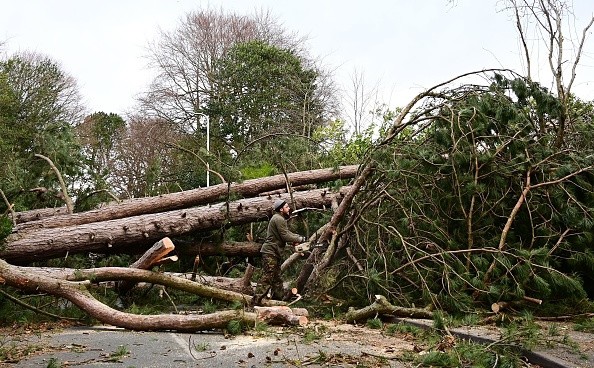
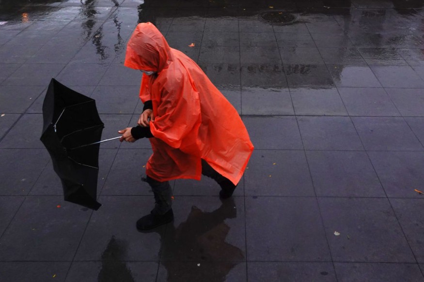
Strong gusts and heavy rain will be a danger even if there are no twisters. Some gusts may reach 75 mph in some areas, which may be dangerous.
Storms should move rapidly enough to keep flooding to a minimum, but some regions may be hit by numerous lines of thunderstorms, increasing the potential of flash flooding.
On Saturday, thunderstorms will continue to travel eastward. Although the chance of severe weather will be lower than on Friday, cities as far north as Philadelphia, Baltimore, and Washington, D.C., may be vulnerable to powerful thunderstorms to start the weekend.
"Gusts of 30-50 mph with locally higher speeds are anticipated from the Great Lakes to the central Appalachians and mid-Atlantic coast on Saturday as a strong cold front moves eastward, and the storm system stays fairly active," Senior Meteorologist Alex Sosnowski said.
Gusts
Gusts might occur at the start of the weekend in the form of heavy rain, short thunderstorms, or even in the absence of rain. A wind gust of 80 mph is possible near the Great Lakes' coasts on Saturday. Strong winds blowing against the water can cause shoreline flooding along the Great Lakes, while short gusts can make navigation difficult and cause flight delays.
The cold front will pass over the East Coast late Saturday night, and there will be no severe weather on Sunday.
For more news about the environment , don't forget to follow Nature World News!
© 2025 NatureWorldNews.com All rights reserved. Do not reproduce without permission.


