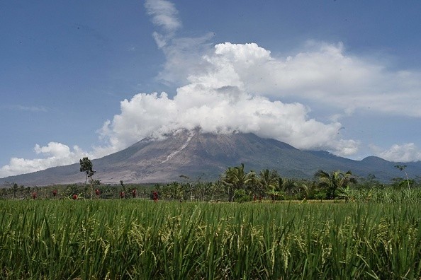
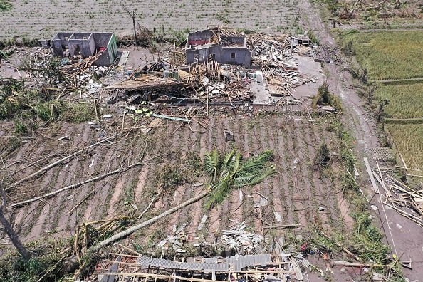
On Saturday, the devastating eruption of Mount Semeru in Indonesia claimed the lives of 22 people, with about 22 missing and 56 injured. More than 5,000 people have been displaced as a result of the eruption, with more than 2,000 taking shelter in 19 evacuation centers.

Impacts of Mount Semeru's Eruption
Saturday's eruption generated a 15-kilometer-high ash plume as well as hot pyroclastic flows, which are thick, fast-moving clouds of hardened lava, ash, and gas. Lahars, or volcanic mudflows, also slided down the volcano's steep slopes. Nearby settlements were buried in ash, and several places temporarily darkened.
Several communities have been buried in up to 4 meters of volcanic material and rubble, over 3,000 structures have been destroyed, and the Gladak Perak Bridge, which connects Lumajang and Malang, has collapsed.
Further pyroclastic flows have been observed down the volcano's slopes, with ash plumes reaching 4.5 kilometers above its peak, according to the Volcano Observatory Notice for Aviation (VONA). Lava flows have also been reported in the top crater.
Mt Semeru is one of Java's most active volcanoes, with eruptions occurring in 74 of the last 80 years, according to News Break.
The current eruptive phase of the volcano started in 2014, with ash plumes reaching hundreds of meters above the crater, pyroclastic flows, and flaming lava avalanches.
Upredicted Larger-scale Eruption
However, Saturday's explosion was far greater than the continuing background of activity, which was anticipated. A thunderstorm and prolonged rain destroyed part of the volcano's lava dome resulting in the eruption.
Volcanic eruptions are often triggered by lava dome collapse, which has been responsible for some of the worst eruptions in history. The unstable dome of solidified lava collapsing is analogous to removing the top from a fizzy drink bottle, which depressurizes the system and causes an eruption.
The fact that Saturday's eruption was sparked by anything other than the volcano's internal conditions would have made this event more difficult to predict.
The most common method of volcano monitoring is to look for signals of growing unrest within the volcano. Increased earthquake activity might indicate that magma is flowing under the earth's surface. A change in the temperature or kind of gases exhaled is another red flag. On the ground or from satellites, tiny changes in the form of the volcano or lava dome may sometimes be noticed.
In 2019, another deadly and unpredictable eruption occurred on Whakaari (White Island) in New Zealand. That event was assumed to be triggered by a blast of pressurized steam rather than magma, making it difficult to forecast.

Living Close to Active Volcanoes
People are increasingly living near active volcanoes as the world's population expands. More than a billion people (14 percent of the world's population) live within 100 kilometers of an active volcano, as per an estimate.
More than 70 percent of Indonesia's population - 175 million people - live within 100 kilometers of one or more of the country's 130 active volcanoes. Over 8.6 million Indonesians live within 10 kilometers of an active volcano, putting them in danger of pyroclastic flows.
Because of the rich soils located around volcanoes, these populations must balance their livelihoods with the dangers. Indonesia's volcano monitoring and disaster management officials have a constant struggle in keeping track of dozens of active volcanoes.
For more news, updates about volcanoes and similar topics don't forget to follow Nature World News!
© 2025 NatureWorldNews.com All rights reserved. Do not reproduce without permission.


