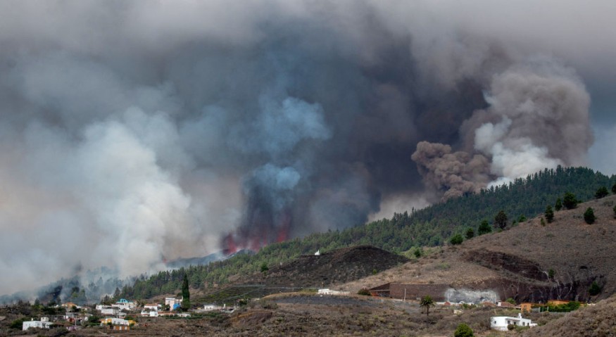
The largest earthquake in Spain, a 4.5-magnitude earthquake, hits Madrid 26 days (about 3 and a half weeks) after the volcanic eruption La Palma began.
According to Spain's National Geographic Institute, the tremor was one of about 60 recorded, as the Cumbre Vieja volcano continued to unleash lava rivers that are devouring everything within their path and throwing molten rock into the Atlantic Ocean.
La Palma's 4.5 Magnitude Earthquake
La Palma is part of the Canary Islands, a Spanish archipelago in the Atlantic Ocean off the coast of Africa whose economy is based on tourism and the production of the Canary plantain.
Around 300 more residents were forced to flee their homes early Thursday as molten lava flows from the Cumbre Vieja volcano threatened to swallow another section of La Palma.
People residing between the villages of Tazacorte and La Laguna were given a few hours to gather their possessions and pets and travel to a meeting location by emergency services.
The flow went through the communities of El Paraiso and Todoque before reaching the Atlantic Ocean on the west coast on Tuesday night, causing fears of explosions and hazardous gas discharge.
As the red-hot current, which reached 1,000 degrees C (1,830 degrees F), contacted the water in the Playa Nueva region, clouds of white vapor rose.
The outflow of molten magma from three rivers widened to 1.7 kilometers (a mile), according to the government of La Palma.
Authorities said hard, black lava has covered 640 hectares (1,580 acres (about the area of Philadelphia Airport)) on the island's western side, but the rest of la Palma remains untouched. More than 1,500 structures have been partially or totally damaged by the lava, however timely evacuations have so far averted deaths. Over 6,000 individuals have been forced to flee their homes.
Also read : 800 Evacuees Fear for Their Lives and Homes as Volcanic Lava Threatened to Engulf Their Town
Earthquake Threat in Spain
The earthquake risk in Spain is categorized as medium. This indicates that in the next 50 years, there is a 10% risk of destructive earthquake shaking.
In the Iberian Peninsula, between 1,200 and 1,400 earthquakes are observed each year. They usually score no higher than 4.9 on the Richter scale, with 5.0 or higher occurring once every three and a half years or so.
The last big earthquake in Spain occurred on February 28, 1969, when a 7.8-magnitude tremor on neighboring Portugal's Cape St. Vincent destroyed numerous houses in the southern Spanish province of Huelva.
A 6.5-magnitude earthquake beneath Arenas del Rey, in Granada province, killed 839 people, destroyed 4,400 houses, and damaged 13,000 others on Christmas Day in 1884.
According to the IGN, on November 1, 1755, an 8.5-magnitude earthquake struck southwest of Cape St. Vincent, causing a 15-meter wave that swept Western Europe and northern Africa, marking the worst quake-related catastrophe in Spanish history. This event became known as the Lisbon earthquake because of the devastation it produced in the Portuguese city, which claimed the lives of an estimated 15,000 people, although it also impacted the Spanish provinces of Huelva and Cádiz.
© 2025 NatureWorldNews.com All rights reserved. Do not reproduce without permission.


