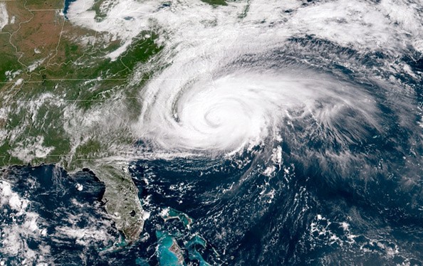
There is a window for the tropical storm to strengthen into a hurricane for a short period of time over the open Atlantic, but it is not anticipated to pose a threat to land, AccuWeather forecasters say.

Tropical Storm Victor
On Wednesday afternoon, the most recent tropical storm of the 2021 hurricane season formed over the eastern Atlantic and has claimed the name Victor which is the name before the last on the season's first list.
The system had formerly been nicknamed Tropical Depression 20, forming in the morning of Wednesday before it suddenly gained more strength through the day. As of Thursday evening, it was situated about 585 miles southwest of the Cabo Verde Islands with up to 60 mph maximum sustained winds.
As per Randy Adkins, an AccuWeather meteorologist, conditions will be suitable for gaining strength over the next couple of days.
Adkins said: "A brief window will exist for the storm to then strengthen into a hurricane, but increasing wind shear and drier air will likely reverse this trend with a gradual loss of wind intensity likely to occur later this weekend into next week."
Talking about the Atlantic's island chain about 950 miles west of Portugal, Adkins said as the situation of things is, this storm will not constitute a direct threat to land, but Azores residents should closely keep an eye on the progress of this system.
Tropical Wave
Forecasters anticipate the development of south to southwest steering breezes over the central Atlantic in the area near Tropical Storm Victor.
These breezes will make the system curve northward over the east-central portion of the basin, welling away from the Caribbean Islands, North America, and Bermuda from the ending of this week into next week.
Victor is one of two regions of disturbed weather that meteorologists have been keeping an eye on over the eastern Atlantic.
Another area of disturbed weather, also referred to as tropical wave which is a few hundred miles farther to tropical storm's west and several hundred miles to the southwest of the Cabo Verde Islands, seem to be not well organized as of Wednesday and had all but destroyed on Thursday.

Hurricane Sam
There is a greater chance the slow organization will stop this more western tropical wave from developing into a tropical depression and storm.
So far, the lack of development is remarkable for the Leeward and Windward islands as this more western feature has a higher chance to get to the islands during the beginning or middle part of next week.
The slow development may allow rising wind shear close to the Leewards and Windwards to completely prevent the formation of the storm.
Bernie Rayno, AccuWeather Chief On-Air Meteorologist said: "A broad area of wind shear is forecast to ramp up this week and persist in the wake of Hurricane Sam."
Related Article: Hurricane Season is Not Slowing Down: Tropical Storm Victor is Brewing in the Eastern Atlantic
For more news, updates about Tropical Storm Victor and similar topics don't forget to follow Nature World News!
© 2025 NatureWorldNews.com All rights reserved. Do not reproduce without permission.


