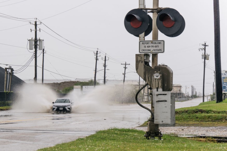
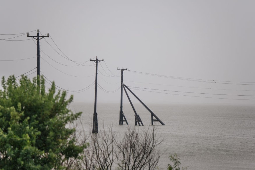
Officials in Texas and Louisiana have issued a warning ahead of the newest tropical cyclone to threaten the Gulf Coast. On Monday night, Hurricane Nicholas was closing in on the Texas coast, and experts warned that the storm might cause severe flooding in the Houston region. On the AccuWeather RealImpactTM Scale, Nicholas received a 1 rating.
Nicholas was moving erratically approximately 20 miles southeast of Matagorda, Texas, at 11 p.m. CDT Monday. The storm had maximum sustained winds of 75 mph and traveled at a pace of 10 mph to the north-northeast. Nicholas is a large storm with hurricane-force winds reaching up to 25 miles from its center.
Weather Alerts

The National Hurricane Center (NHC) issued a hurricane warning for Port O'Connor north to Freeport, Texas, and a hurricane watch for the Texas coast from Freeport to San Luis, Texas. In addition, tropical storm advisories and storm surge warnings were in effect for sections of the Texas coast.
Louisiana Governor John Bel Edwards announced a state of emergency on Sunday, while Texas Governor Greg Abbott upped the state's emergency alert level and prepared event management teams, including swift water rescue boat squads.
Related Article : Meteorologists Predicts that the Atlantic Hurricane Season Will Inevirably Be More Aggressive
Erratic Behavior
According to Hurricane Expert Dan Kottlowski, the center of Nicholas formed and re-formed several times Sunday night and Monday as the National Hurricane Center described its behavior as erratic, with the latest center appearing farther east and offshore of the Texas coast Monday morning.
Despite Nicholas' erratic behavior early Monday, forecasters expect the storm's general northward movement to continue, with landfall likely over the next few hours along the middle part of the Texas coast, near the eastern part of Matagorda Bay. However, additional shifts in the storm's center and changes in exact timing and landfall are possible.
Wind Shear
While wind shear and closeness to the Texas coast will likely restrict Nicholas' total strength, waters in the western Gulf of Mexico are well into the 80s F, which is more than warm enough for a tropical cyclone to flourish.
Dangers of Flooding

Flooding will pose a significant danger to people and property. According to the projected trajectory, the rain will fall over a vast region to the north and northeast of the storm's core, which encompasses a significant chunk of southeastern Texas and part of Louisiana.
Abbott stated that Texas had mobilized resources ahead of Hurricane Nicholas, which was already dumping heavy rain on coastal regions Sunday night and Monday morning. "We'll keep an eye on this storm and take all necessary steps to keep Texans safe," he added. "I urge Texans to heed local officials' advice and warnings and to be aware of the possibility of severe rain and flooding."
Moving from Texas to Louisiana
Nicholas is anticipated to travel a curving route northward to the central Texas coast Monday night, then northeastward over part of the upper Texas coast and into western Louisiana on Tuesday.
Although Nicholas is expected to move slowly on Tuesday, the storm will bring a massive amount of moisture in from the Gulf of Mexico, resulting in torrential rain along and inland from the coast, including the areas from Corpus Christi to Beaumont, Texas, including the Houston metro area, as well as Lake Charles and Alexandria, Louisiana.
During Monday night and Tuesday, the heavy rainfall over the Gulf of Mexico will rotate northwestward relative to the center of Nicholas.
For more climate and weather updates, don't forget to follow Nature World News!
© 2025 NatureWorldNews.com All rights reserved. Do not reproduce without permission.


