Danny made landfall as a tropical storm off the coast of South Carolina on Monday evening, only hours after being declared the fourth named storm of the 2021 Atlantic hurricane season.

Landfall
The storm made landfall on Pritchards Island, South Carolina, just north of Hilton Head, with maximum sustained winds of 65 mph. The storm was downgraded to a tropical depression with maximum sustained winds of 35 mph around 11 p.m. EDT Monday. The storm was about 50 miles west-northwest of Beaufort, South Carolina, and moving west-northwest at 15 miles per hour.
Losing Strength

As the hurricane loses its strength over land, the tropical storm warning that was in place for parts of South Carolina has been lifted.
After reviewing Doppler radar data from Charleston, South Carolina, and early data from a Hurricane Hunter flight, the National Hurricane Center (NHC) named the storm Danny after 3 p.m. EDT Monday.
The system's course to the west-northwest took it over the Gulf Stream's warm waters on Monday, allowing it to grow into a tropical storm.
Causing Trouble
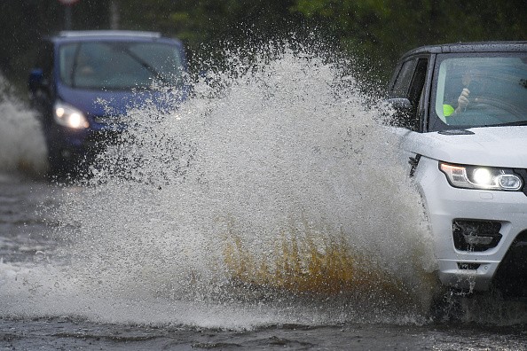
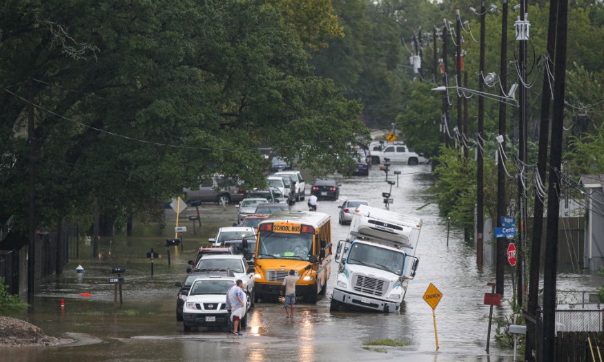
The storm's major impact on Georgia and South Carolina has been heavy rain, with 3-5 inches of rain reported in certain areas.
On Tuesday and Tuesday night, downpours and strong thunderstorms will move further inland, hitting the southern Appalachians and Tennessee Valley.
Locally severe downpours can cause small traffic delays in Atlanta, Huntsville, and Birmingham, Alabama, as well as Chattanooga, Tennessee.
A calm had formed over the Atlantic basin following Claudette's passage across the Southeast in late June, before the formation and impact of Danny.
According to AccuWeather's meteorologists, Danny may not be the only tropical cyclone to form in the Atlantic this week.
"An area of low pressure contained within a powerful tropical wave in the eastern Atlantic that is producing regions of rain and thunderstorms is another feature being studied for development," Senior Meteorologist Adam Douty said.
Low Pressure Area

Meteorologists have been keeping an eye on this low, known as Invest 95L, since last week.
"As it moves over the Atlantic, there may be some slow growth, and this may gather enough organization to become a tropical depression," Douty said.
Even if this feature fails to form a tropical system, forecasters predict gusty showers and thunderstorms in the Lesser Antilles and the northern Caribbean by the middle of the week.
Suspicious Region
A third suspicious region of showers and thunderstorms is also being watched.
Since the weekend, a wide region of unsettled weather has lingered over the western Gulf of Mexico. Satellite pictures and radar loops over the Gulf near the Texas-Mexico border revealed a relatively feeble circulation.
By midweek, this disturbance will have moved inland, thus ending any possibility of growth. However, the large region of disturbed weather across the western Gulf, southeastern Texas, and northern Mexico will continue to generate downpours and occasionally gusty thunderstorms through Wednesday.
Meteorologists anticipate an above-average Atlantic hurricane season, with 16-20 named storms, seven to ten of which are expected to become hurricanes. There have been three tropical storms in the Atlantic basin so far in 2021.
Enrique

Meanwhile, the first hurricane of 2021, Enrique, formed in the seas off the coast of southern Mexico. Enrique will continue to saturate south Mexico with torrential rains through Wednesday, with the possibility of reaching landfall in a weakened condition near Baja California's southern coast.
Late this week or this weekend, some precipitation from Enrique might be pushed northward and into the southern United States.
For more climate and weather updates, don't forget to follow Nature World News!
© 2025 NatureWorldNews.com All rights reserved. Do not reproduce without permission.


