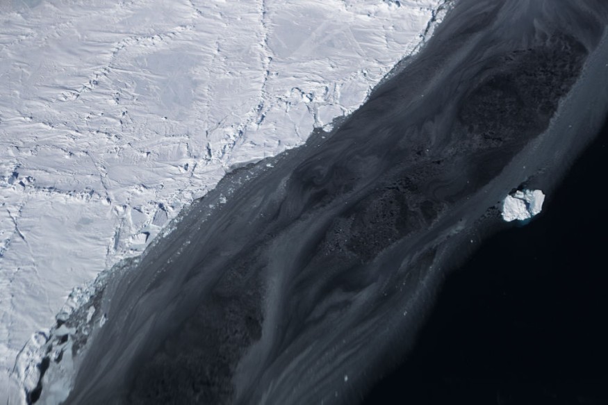
An enormous piece of iceberg larger than New York's Long Island was seen breaking and floating away from the Earth's southernmost continent. The iceberg named A-76 is located west of Ronne Ice Shelf, Weddell Sea, in Antarctica and measured around 4320 sq km in size, which now makes the largest berg according to the European Space Agency (ESA).
The A-76 satellite image was captured by the Copernicus Sentinel-1 mission. Antarctica looked like it gave birth to an iceberg around 170 km in length and 25 km wide. Its giant size was described as slightly larger than the Spanish island of Majorca and calved similarly to Long Island.
It broke off the record of world's largest iceberg, which was previously the place of A-23A iceberg, now holding second place after A-76 discovery. The A-23A iceberg is approximately 3880 sq km in size, also lying in the Weddell Sea. For comparison, an A-74 iceberg from Brunt Ice Shelf on last February this year was only 1270 sq km.
Iceberg Qualities
For an ice to qualify as an iceberg, it must possess an ice block higher than 4.8 meters (16 feet) above sea level, be at least 29 to 49 meters thick and cover an area of at least 500 square meters, according to the US National Oceanic and Atmospheric Association.
When the British Antarctic Survey spotted A-76, US National Ice Center confirmed it was an iceberg and observed its journey from the Copernicus Sentinel-1 imagery, two polar-orbiting satellites which can provide data regardless of time, making year-round viewing of remote regions like Antarctica possible.
Icebergs traditionally get their names from the Antarctic quadrant they were first-sighted, followed by a sequential number, and when it breaks, a sequential letter.
Natural Polar Cycle
While the giant iceberg currently made it to world's largest iceberg, it is incomparable to the gigantic A-68 iceberg in 2017 fragmented from the Larsen ice shelf, but fortunately warmed faster before it could damage any abundant wildlife in the British Overseas Territory of South Georgia.
The said iceberg holds a size of around 5,800 km2, 350 meters thick. Anne Braakmann-Folgmann, a researcher in iceberg motion believe that the A-76 might follow the trajectory of A-68 towards South Georgia.
Generally, melting of ice can be a centuries-old natural cycle and not exactly a cause of global warming due to human activities. Natural changes in Earth's climate usually leads to series of dislodged large ice blocks, and scientists believe the latest happening of A-76 was part of a natural polar cycle.
Alex Brisbourne, a Glaciologist at the British Antarctic Survey explained that breaking off of chunks of ice is a needed balance as Antarctica continues to feed ice to its ice shelves. In addition, pieces of giant ice floating away from glaciers does not contribute to rise in sea level as they melt, because they were already-floating in the first place.
Scientists are currently keeping a keen eye on the floating A-76 to determine if it will pose a threat to shipping lanes or other areas.
© 2025 NatureWorldNews.com All rights reserved. Do not reproduce without permission.


