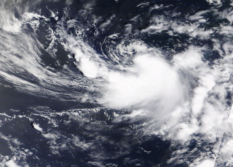
On June 23, 2020, Tuesday morning, a monitored system over the North Atlantic Ocean was classified as a subtropical depression, but by the afternoon of the same day, that subtropical depression acquired tropical storm characteristics; it was soon named Dolly, and a NASA satellite took an image.
The newly emerged tropical storm was photographed by the Terra satellite of NASA. It was classified as a storm at 1 PM EDT or 1700 UTC. The National Hurricane Center or NHC named it 'Dolly' and gave the following details: at 9:48 AM EDT or 1348 UTC, the ASCAT-A scatterometer monitoring the area made a pass just as the sub-tropical category advisory was announced, and showed that the previous subtropical depression's southern semi-circle now has winds with speeds of 35-40 knots (equivalent to 40-46 miles per hour [mph] or 65-74 kilometers per hour [kph]).
The ASCAT-A or Advanced Scatterometer is an instrument in satellites that are used to measure wind direction and speed.
Additionally, the radius of the maximum winds is now contracted to roughly 40 nautical miles. Such transformation, combined with its present convective pattern, is suggestive of the system already transitioning from a sub-tropical depression to a full tropical cyclone. Thus the storm was designated Tropical Storm Dolly.
Dolly's center has been located near the coordinates latitude 39.4º N and longitude 61.7º W. This location is roughly 600 kilometers or 370 miles south-southeast from the city of Halifax in Nova Scotia, Canada. Tropical Storm Dolly was seen to be moving towards an east-to-northeasterly direction at almost 20 kilometers per hour or 13 miles per hour. Tonight and tomorrow, Wednesday, June 24, it is expected to turn towards the northeast accompanied by increasing forward speed.
The wind data obtained from the satellite monitor showed an increase in the maximum sustained winds to almost 45 mph or 75 kph and higher gusts. The tropical storm force winds are also extending outward to a maximum of 70 miles (or 110 kilometers) going south of its center. They have an estimated minimum central pressure of 1,002 millibars.
The Terra satellite of NASA has a MODIS instrument onboard or the Moderate Resolution Imaging Spectroradiometer. It photographed an image of the coming Tropical Storm Dolly in its current status over the western part of the North Atlantic Ocean last June 23 at 1:30 PM EDT. The satellite data image shows thunderstorms forming a thick band that wraps around its center through the storm's east to south quadrant. The picture was produced by NASA's Worldview in Greenbelt, Maryland, at the Goddard Space Flight Center.
According to the NHC, they are forecasting a weakening of Dolly in the coming one or two days as it moves over cooler waters. By Wednesday, they are expecting the system to turn post-tropical, and by Thursday morning, the low is expected to have dissipated.
The Terra satellite owned by NASA is among the fleet of satellites that NASA uses to provide satellite data to be used in researching hurricanes. Hurricanes or tropical cyclones are no trivial matter, and NASA contributes to public services by helping forecast hurricanes and weather.
Visit the NHC website for updated information.
© 2025 NatureWorldNews.com All rights reserved. Do not reproduce without permission.


