Weather experts said that the southwestern portion of the United States would experience surge of heat that will later bring the warmest temperatures since 2023.
Long-lasting Heat
Based on the forecast, the first widespread and long-lasting surge of heat will be felt over the interior southwestern United States over the weekend up to early next week.
The region has been known for its searing heat and relentless sunshine most days from the late spring up to the middle of autumn.
Meteorologists said that the average date for the first 90-degree Fahrenheit high temperatures in Las Vegas was on April 18. They bared that the temperatures are forecasted to hit that mark from later this weekend to early next week.
On the other hand, Phoenix is expected to hit the 80-degree mark year-round, with the average first 90-degree day on March 30.
Weather experts explained that it took almost another two weeks before the temperature reached 90 at Sky Harbor International Airport in Arizona, with a high of 94 on April 11.
Authorities advised that those seeking relief from too much heat and are close enough to the Pacific Ocean can find significantly lower temperatures at the California beaches.
They said that high temperatures during the weekend would generally be in the 60s, such as at Malibu Beach, California, where low morning clouds will yield afternoon sunshine.
Meanwhile, residents and tourists may also find relief by heading to the mountains, where the air is expected to be cooler.
The said pattern will offer almost zero risk of thunderstorms over much of the areas in the region, and this can spoil hiking adventures during the summertime.
Due to the threat of the heat, the public has been reminded to limit exposure to the sun during the middle of the day and afternoon hours when the rays are the most intense.
Experts suggested that people who plan on spending time outdoors should wear sunscreen.
The interior of vehicles and pavement can become dozens of degrees hotter than the air temperature.
Parents should also never leave children or pets unattended in vehicles, and people should also avoid walking pets on paved surfaces during the daytime. Temperatures inside a vehicle can reach life-threatening levels in minutes, and the hot pavement can instantly burn the animals' paws.
Read Also: Extreme Heat Wave in Africa's Sahel Region That Killed 100 People Linked to Climate Change
Showers, Thunderstorms
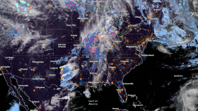
On the other hand, showers and thunderstorms will continue over parts of the Southeast to the Southern Plains.
Further, a front will come onshore over the Pacific Northwest on Saturday afternoon and move eastward to the Northern High Plains and Great Basin by Sunday evening.
The system will produce rain over parts of the Pacific Northwest Coast through Sunday evening.
When it comes to the overnight of Saturday, light snow will develop over the Cascades and parts of the Northern Intermountain Region by early Sunday morning, and this is seen to continue into Sunday evening.
Also on Saturday, as the front settles over the Gulf Coast, showers with strong to severe thunderstorms will develop over parts of the Southern Plains and Southeast.
Therefore, authorities have already issued a Marginal Risk (level 1/5) of severe thunderstorms over two areas, the Southern Plains/Western Gulf Coast and the second area over the Southeast from Saturday into Sunday morning.
Related Article: US Thunderstorm Forecast: Southeast at Risk of Strong Winds and Hail This Weekend [NWS]
© 2024 NatureWorldNews.com All rights reserved. Do not reproduce without permission.